
JPL scientist Paul Rosen on what NISAR’s first months in orbit reveal about our changing planet
Paul A. Rosen, project scientist at NASA Jet Propulsion Laboratory (JPL), will deliver the Pickering Lecture at ASCEND 2026 on Thursday, 21 May.
A 34-year NASA veteran and JPL Fellow who specializes in interferometric synthetic aperture radar (SAR), Rosen will detail early findings from the NASA-ISRO Synthetic Aperture Radar (NISAR) mission and how it is changing the ways scientists and agencies monitor Earth.
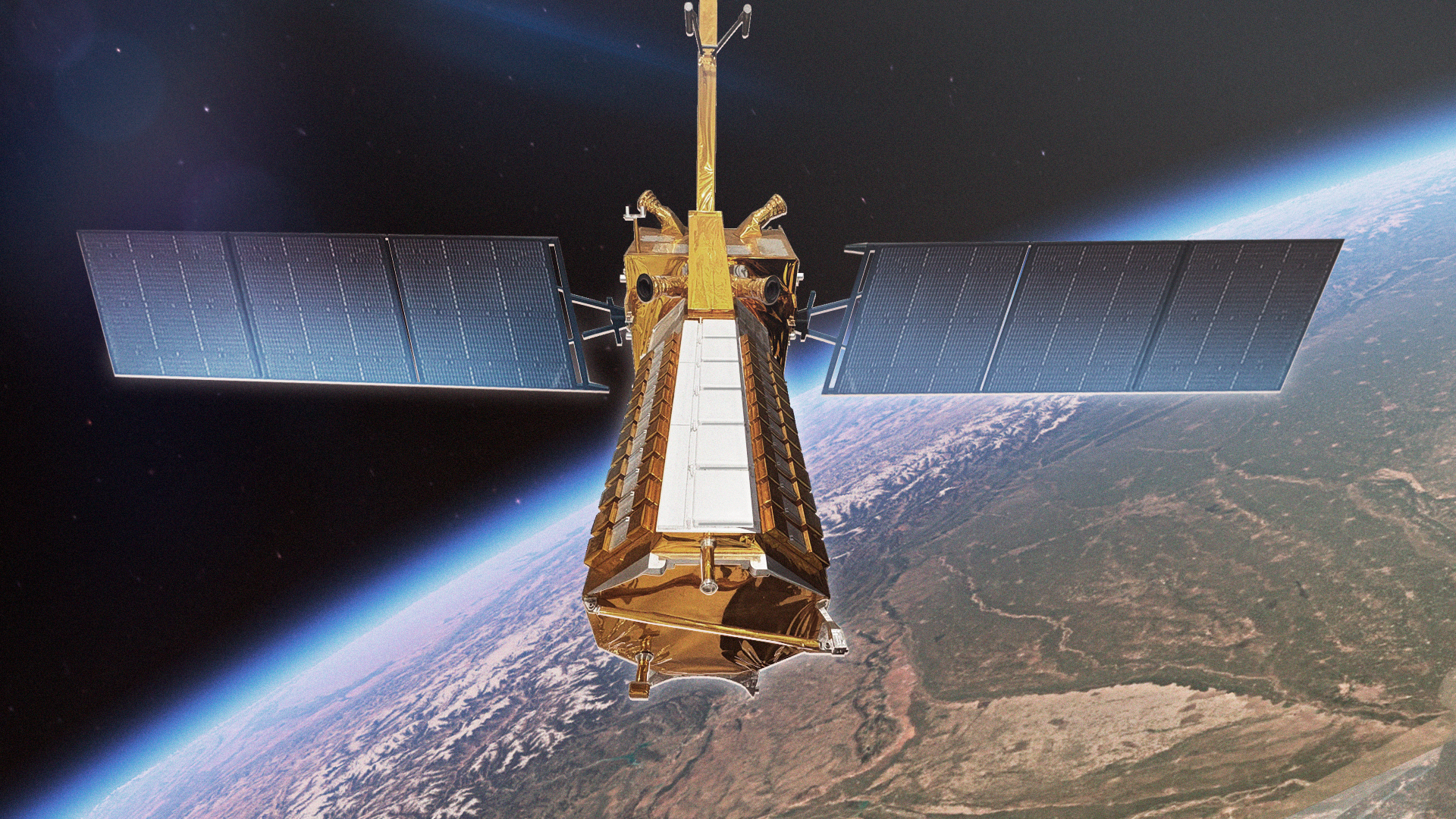
His lecture, “The NASA-ISRO Synthetic Aperture Radar Mission – A Landmark for Earth Science and Applications,” covers a mission launched on 30 July 2025 as the largest space partnership to date between NASA and the Indian Space Research Organisation (ISRO).
Rosen’s talk will cover the technical design, joint development timeline, and early science and applications pipeline – including how the dual‑frequency radar and multiple polarization modes distinguish vegetation types, soil and ice properties, and urban infrastructure. Attendees will receive an early, data‑driven update on how NISAR is performing against its design goals – covering initial imagery from the mission’s first months in orbit and the science drivers behind global 12‑day repeat coverage. The lecture will also address planned applications in disaster response, agriculture, climate, and land‑use monitoring, and lessons learned from running a multiagency radar mission at operational scale.
NISAR carries two radar instruments — an L-band system built by JPL, and an S-band system built by ISRO — and flies in a 12‑day exact‑repeat orbit, generating dense time series of centimeter‑scale surface deformation and weekly land‑cover change worldwide. Because radar works regardless of cloud cover or daylight, the mission delivers reliable, repeatable measurements at a global scale – and is the first SAR system designed to provide analysis‑ready data products on a routine basis.
Monitoring a Continuously Changing Planet
Earth’s surface is in constant motion – glaciers and ice sheets flow seasonally, tectonic plates shift relentlessly, earthquakes strike in an instant, and soil moisture and landscape cover change daily. Those shifts carry real consequences for agriculture, disaster risk, and climate monitoring.
“All these changes impact human lives, directly and indirectly. Knowledge of soil moisture helps farmers; understanding ice sheet variability helps understand climate risks. Monitoring earthquakes helps with response and understanding of future risks,” Rosen noted.
Ultimately, NISAR will support global‑scale science and applications – from tracking soil moisture, forest cover, and agricultural activity to enabling inventory assessments and new value‑added services developed by public and private users.
Calibration Phase with Early Event Products
NISAR is currently in its calibration and validation phase, with formal disaster-response products not yet released. Even so, the team has already tested the mission’s L-band radar system in Palos Verdes and Big Sur, California, during ongoing large landslides; in Ethiopia and Australia after earthquakes struck; and in Jamaica in late October when Hurricane Melissa, one of the strongest Atlantic hurricanes on record, made landfall. These early tests demonstrate the instrument’s responsiveness and potential utility ahead of routine data distribution.
Routine disaster-response products will follow after calibration, at which point NISAR will add a high‑resolution SAR capability to the international constellation of Earth‑observing satellites that support emergency management and long‑term resilience planning.
NASA–ISRO Partnership at Mission Scale
The mission is also a test case for large‑scale international collaboration. “ISRO was an essential partner, providing the spacecraft bus, an S‑band radar instrument, the launch vehicle, and ongoing mission operations. We have worked side by side for over 15 years to realize this mission,” Rosen explained. With shared responsibility for the spacecraft, radar payloads and operations architecture, the agencies will deliver freely available data for global use.
With global coverage, analysis‑ready outputs, and open data access, NISAR is positioned to serve researchers, space agencies, agriculture ministries, disaster management authorities, and commercial analytics providers alike.
About the Pickering Lecture
The Pickering Lecture is named for former JPL Director William H. Pickering, who helped establish the United States’ robotic space program. His leadership extended from Explorer I in 1958 – America’s first successful satellite – through the Viking Mars orbiters and the Voyager missions to the outer planets and into interstellar space. The lectureship recognizes missions and leaders whose work advances robotic exploration and scientific discovery.
