
U.S. military funds major sensor system projects
Investments in sensor systems and information fusion for aerospace applications have increased the past several years in part due to new opportunities in the use of drones, networked systems and small satellites, and the U.S. Department of Defense’s increased emphasis on artificial intelligence applications.
The DOD is reaping the benefits of its push to incorporate AI and machine learning into operations and products — but not without growing pains. The DOD established the Algorithmic Warfare Cross-Functional Team, or AWCFT, in 2017 to integrate AI and machine learning more effectively across operations. One of the early projects, Project Maven, focuses on applying Google’s TensorFlow application program interface to assist in object recognition in unclassified imagery data. In May, Bob Work, a Project Maven founder, said the program is “exceeding my expectations.” Also that month, U.S. Air Force Lt. Col. Garry Floyd, deputy chief of the Algorithmic Warfare Cross-Functional Team, said that Maven was active in “five or six” combat locations. Concerns over future uses of the technology forced Google in June to withdraw from participating in any follow-on to Project Maven once the contract expires in 2019.
The Pentagon created the Joint Artificial Intelligence Center in June. It will have oversight of service and defense AI projects over $15 million. It is charged with establishing a common set of AI “standards, tools, shared data, reusable technology, processes and expertise” for the Defense Department.
DARPA announced its Artificial Intelligence Exploration program in July to establish a series of “unique funding opportunities” to push the state-of-the-art, focusing on the “third wave” of AI theory. DARPA defines the first wave as rules-based and the second as “statistical learning.” The third wave is aimed at machines that can “contextually adapt to changing situations.”
In February, officials at the Air Force Research Lab announced plans for a five-year sensor-fusion program to cost $33.6 million. The goal of the Precision Real-time Engagement Combat Identification Sensor Exploitation, or PRECISE, project will be to make it easier for troops to identify targets at long ranges. The project’s mission is to improve radar technologies that identify air and ground targets for aircraft. The Defense Department announced in October that it had awarded Northrop Grumman a $16.5 million contract for the program.
Researchers at the University of Waterloo announced in April that they are developing a technology that promises to help radar operators cut through heavy background noise and isolate targets, including stealth aircraft and missiles, with unparalleled accuracy. Quantum radar uses a sensing technique called quantum illumination to detect and receive information about an object. At its core, it leverages the quantum principle of entanglement in which two photons form a connected, or entangled, pair. This can greatly improve the radar signal-to-noise ratio in certain situations.
NASA launched the Transiting Exoplanet Survey Satellite in April aboard a SpaceX Falcon 9 rocket. TESS has a camera suite composed of four wide field-of-view optical cameras that will be able to monitor a much larger sample of stars compared to its predecessor Kepler. TESS scientists expect the mission will catalog thousands of planet candidates and vastly increase the number of known exoplanets. Of these, approximately 300 are expected to be Earth-sized and super-Earth-sized exoplanets.
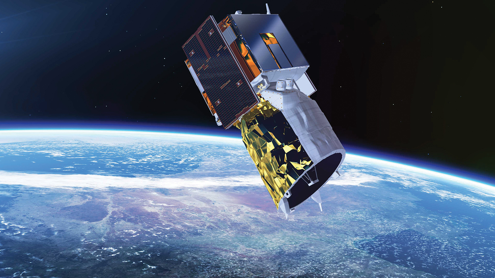
On Aug. 22, Airbus launched the European Space Agency’s Aeolus satellite on a Vega rocket. The satellite features, the first space-borne light-detection and ranging instrument, which uses the Doppler effect to determine the wind speed at varying altitudes. It will improve the accuracy of numerical weather and climate prediction and advance understanding of tropical dynamics and processes relevant to climate variability.
Contributors: Kent R. Engebretson and J. Chris Aguilar
Image: An illustration of the Aladin instrument, a wind lidar, aboard the Aeolus satellite. Credit: European Space Agency
