The current generation of U.S. geostationary weather satellites can't plumb the atmosphere to produce temperature and moisture measurements, as previous versions did with sounding instruments. As NOAA plans its next-generation constellation, Jon Kelvey looks at the odds forecasters will get their sounders this time.
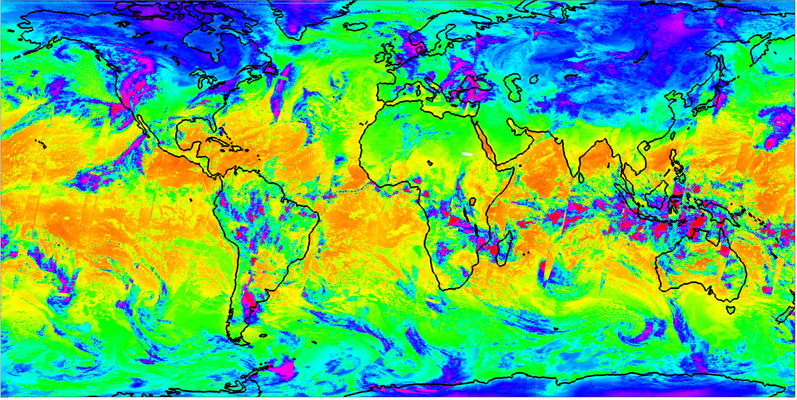
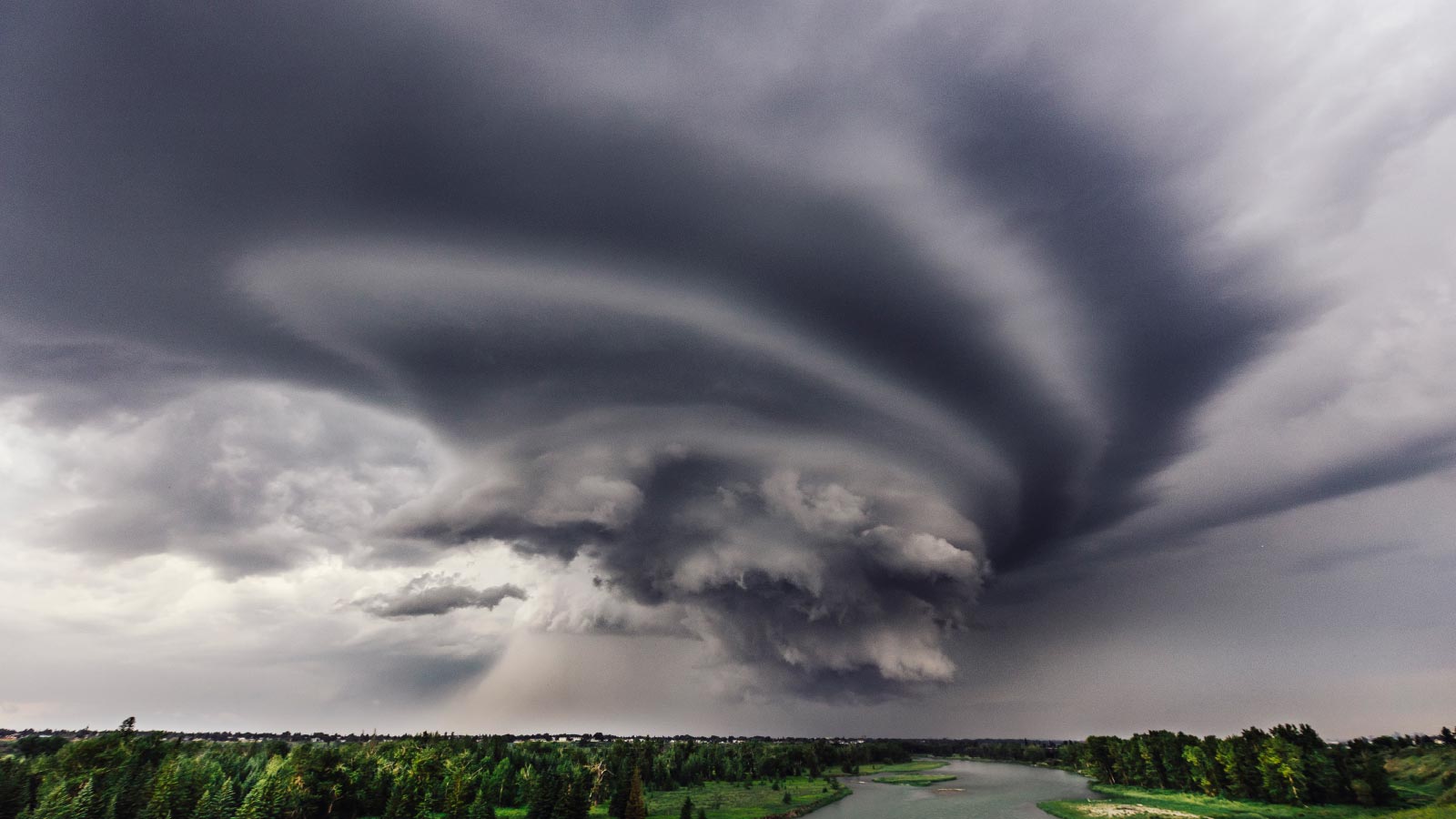
From its position 35,000 kilometers over the equator, NOAA’s newest geostationary weather satellite can record lightning strikes over half the globe at 500 frames per second and take a snapshot of the Western Hemisphere every 10 minutes, not just in visible bands but also in infrared ones, and with enough fidelity to see the billowing smoke from wildfires burning throughout New Mexico in early May.
But what GOES-18 can’t do is profile the temperature and humidity of the atmosphere by altitude. Doing that would require a sounder, a camera-like device whose detector materials would be chosen for their sensitivity to numerous fine-scale ranges of infrared wavelengths, or bands. Most ideally, the sounder would be a hyperspectral one, meaning it would be sensitive to thousands of such bands. Back in 2007, a consulting group hired by NOAA concluded that geostationary satellites equipped with powerful cameras and hyperspectral sounders could save “millions if not billions of dollars for any given storm” by improving forecasts and avoiding needless evacuations from river flooding and coastal storm surges.
NOAA published this economic analysis during what was at times an emotional debate over which instruments should go on the GOES-R series of school bus-sized satellites. The proposed sounders were dropped by NOAA for reasons of budget pragmatism during that formulation phase. NOAA does fly sounders today on satellites that orbit from pole to pole, but those instruments don’t provide the nearly constant eye of geostationary spacecraft.
But now, 2022 could be the year of the rebound for geostationary sounders. In about a decade, a far more sensitive hyperspectral sounder than the one proposed for GOES-R could ride on a satellite dedicated to it, according to NOAA’s early plan for its next-generation weather satellites, the Geostationary Extended Observations, or GeoXO, constellation.
This would be a huge shift from NOAA’s approach since the 1970s of positioning one GOES satellite over the East Coast to watch the Atlantic Ocean and another over the West Coast to watch the Pacific Ocean.
This time, NOAA plans to fly one in the east, one in the west and a third between them over the central part of the country. That’s the one that would be equipped with the sounder — a compromise because NOAA doesn’t have the funding to put sounders on the two satellites in the east and west posts. From the central position, the sounder could detect and track severe weather including flash floods and tornadoes as they form, and indicate when residents need to be warned to take shelter or evacuate. The satellite could aid with tropical and coastal storm forecasting, but would be less ideal than if there were sounders in the east and west slots.
NOAA is considering buying six GeoXO satellites in total, with the first to be launched in the 2030s.
This plan would be a welcome turnaround for forecasters.
“That was a big disappointment when [the sounder] didn’t get on the GOES-R series,” says Tim Schmit, a NOAA research meteorologist and sounder design instrument scientist for the GeoXO program. The proposed GeoXO sounder would do an even better job of measuring vertical changes in temperature and moisture, he adds, which are “the key to forecasting convection” and related severe weather.
But the sounder isn’t a done deal yet. NASA, which oversees the design, construction and launching of NOAA’s weather satellites, awarded two $8 million study contracts in October to Ball Aerospace and L3Harris to come up with competing designs and “really help us understand exactly what can be built, let us finalize the requirements, and will inform ultimately the final program,” says Pam Sullivan, program director for GeoXO and GOES-R.
The decision on the final collection of instruments for GeoXO is scheduled to be made in December in the form of a Milestone 2 review “where the Department of Commerce and NOAA agree, ‘This is the program I want to build, this is the money I’m willing to pay,’” Sullivan says. “That would be formal approval of the program.”
That’s about the same point in the development process, she adds, where the GOES-R sounder was nixed.
Plumbing the atmosphere
A sounder is all about obtaining information as a function of altitude, or depth, depending on how you think of it, says David Johnson, an instrument scientist at NASA’s Langley Research Center in Virginia, who has joined the GeoXO program as the instrument scientist for the GeoXO sounder, or GXS.
“I’m not sure of the origins of that word, but it makes me think of people on ships and depth sounding, dropping stuff overboard,” Johnson says of sounding. But rather than plumbing ocean depths, an instrument like GXS produces atmospheric soundings.
For satellites equipped with infrared detectors, sounding relies not on weights and ropes but on the relative opacity of the atmosphere below. That is, how much infrared light emitted by the ground and clouds reaches the sounder instead of being absorbed by carbon dioxide, water vapor and other atmospheric constituents along the way.
“Consider an infrared photon emitted at the surface of the Earth at a wavelength corresponding to a CO2 absorption feature,” Johnson says. “The photon is quickly absorbed by the atmosphere, emitted again, absorbed again, and so on until it reaches an altitude where the atmosphere is thin enough that the photon can escape to space.”
Since CO2 strongly absorbs infrared light in the 15-micrometer wavelength, he adds, a sounder monitoring the 15-micrometer wavelength only “sees” the highest levels of the atmosphere. Infrared light emitted by the Earth’s surface at around 11 micrometers, however, can reach the sounder with little attenuation if the sky is clear.
So “by observing the Earth in a range of wavelengths where CO2 absorbs more and less strongly,” Johnson says, “one can observe the brightness higher and lower in the atmosphere, and from that one can derive the temperature.”
A sounder applies the same process to water vapor, which strongly absorbs infrared light at the 6.7-micrometer wavelength. Once scientists calculate temperature as a function of opacity, they can use the well-known abundance of CO2 in the atmosphere to estimate temperature as a function of pressure and altitude. Then do the process again with respect to water vapor to get a profile of water vapor by altitude.
“Those are the two really, really important things for weather guys, to get temperature and water vapor,” Johnson says.
With temperature and humidity, weather forecasters have new insights into convection and precipitation. Monitor these over time or plug them into weather models, and they can determine wind velocity. All key ingredients for knowing where severe weather is right now — and where it will be in the future.
Bringing back sounding
Sounders go back nearly to the origin of the GOES satellites. GOES-1 reached orbit in 1975 with a rudimentary instrument package that provided no information on cloud depth, moisture or temperature by altitude. But GOES-4, launched in 1980, carried a demonstration version of a sounder to geosynchronous orbit: the Visible Infrared Spin-Scan Radiometer Atmospheric Sounder.
That sounder with its 12 spectral bands was deemed a success, Schmit says, and a sounder with 18 infrared spectral bands was included on the GOES-8 satellite launched in 1984.
NOAA flew similar sounders through GOES-15, and in the early 2000s began to plan for the next-generation instrument that would have flown on the GOES-R series: the Hyperspectral Environmental Suite. It would have consisted of a hyperspectral sounder and a coastal waters imager. The combination may have been too ambitious, Schmit says, and the combined hurdles of funding and technical difficulty ultimately led to NOAA removing the sounder from GOES-R.
NOAA has also flown hyperspectral sounders aboard low-Earth orbit satellites in polar orbits, such as the Suomi National Polar-orbiting Partnership, a multiagency climate and weather satellite, and NOAA-20, both part of Joint Polar Satellite System. The data they provide has proven valuable, Schmit says, but with a revisit time of 12 hours, their utility in monitoring severe weather events is limited.
“A lot of weather can have hit in 12 hours,” he says. “You can go from clear to clear, if you will, with a big storm in between.”
The legacy sounder that flew on GOES-15, the last satellite of the generation that came before GOES-R, could beat a hyperspectral sounder on a polar orbit in terms of temporal resolution. Instead of 12 hours, the GOES sounder could scan the continental U.S. about every hour.
If approved, the GeoXO sounder by contrast would represent a huge jump forward in terms of temporal, spectral, and spatial resolution, capable of scanning a “full disk” of the Earth every 30 minutes, Schmit says, and doing so with finer spatial resolution than the sounders in LEO.
“We’re looking at something on the order of 4 kilometers for the GeoXO sounder, compared to something like 12 to 16 kilometers with current LEO satellites,” he says.
And while the GOES-15 sounder viewed 18 spectral bands, the GeoXO sounder would view 1,564 spectral bands, according to Johnson. Combined with the faster revisit times, it could produce 80 times the data of a sounder in LEO. “That’s 7 million pieces of information per second, versus 86,000 from LEO,” he says.
Real-time forecasting
With that kind of resolution and data flows, GeoXO could move into the domain of nowcasting — weather predictions delivered within a few hours of data collection — and advanced weather modeling. This could help decision-makers pre-position utility workers, food and water, or other resources before severe weather hits and make adjustments in real time, says James Yeo, the sounder user scientist for the GeoXO program.
“If you’ve ever had power out after a storm of any kind, you appreciate how quickly linemen get out there and restore services,” he says. “Having them at the right place in the right number is just a huge, huge factor.”
The more severe the weather, the bigger the potential impact. Yeo works within the National Centers for Environmental Prediction within the National Weather Service, which include the Aviation Weather Center, Climate Prediction Center, Storm Prediction Center and Hurricane Prediction Center, among others, all of which share a mission to provide forecasts to help protect lives and property. The GXS could help enhance that forecasting, and support or supplant existing techniques for gathering data on extreme weather, such as hurricanes.
NOAA hurricane reconnaissance aircraft release dropsondes — aerodynamically shaped cylinders loaded with instruments and dropped under parachutes — to acquire the exact sort of information about major storms that the GXS could provide from space, Yeo notes. While such a flight can provide great data, releasing perhaps 30 dropsondes every 15 minutes over the course of an 8.5-hour flight, the GXS could obtain data every 30 minutes, no aircraft required.
And while existing satellite data is helpful for forecasts of storms and icing that affect aviation, Yoe says, the GeoXO sounder’s finer spatial resolution will improve the fidelity of real-time monitoring and response to atmospheric conditions, allowing airlines to better avoid costly turbulence.
“When you know the wind speed and direction with some degree of accuracy at different levels, then you can infer where the shear is,” he says, referring to the change of wind speed over short distances that often occurs during storms. “And where the shear is, from an aircraft’s point of view, that’s where turbulence is going to be.”
But perhaps the most exciting application for a hyperspectral GEO sounder, from the point of view of forecasters and meteorologists like Yeo and Schmit, is how the data will enhance models to predict severe weather farther into the future than is currently possible.
“If you want to know where the lightning is, make sure you have a lightning mapper. If you want to know where the lightning is going to be in up to an hour, get an imager,” Schmit says. “If you want to know where the lightning is going to be in two hours, you have to get a sounder.”
But even if the sounder is approved as part of the GeoXO design in the Milestone 2 review in December, twin challenges of congressional funding and technological hurdles could force NOAA to descope GeoXO in some fashion, which could include dropping the sounder.
The current estimated cost for GeoXO — consisting of six satellites, 24 instruments, grounds systems, development, and 20 years or more of operation — is about $18.6 billion, says Sullivan, slightly more than the $11.7 billion cost for the GOES-R series, when adjusted for inflation.
“There’s no question that we’re going to have a next-generation GOES satellite,” she says. “I think the question is, ‘how capable?’”
NOAA’s Schmit, for one, is fairly optimistic about the sounder’s chances of making it into the final GeoXO satellites. Since the decision to take the sounder off GOES-R, other countries have launched weather satellites with similar instruments, so the U.S. will have time to learn from others and build the best instrument possible.
China in 2016 launched an experimental sounder on one of its Fen-Yun 4 weather satellites, and the European Organization for the Exploitation of Meteorological Satellites is studying the potential of including a hyperspectral sounder on one of its GEO Meteosat satellites scheduled to launch in 2023.
If it makes the cut, the GeoXO sounder would become “kind of part of this global ring,” Schmit says. “It’s our contribution to the global ring of advanced geostationary sounders.”
A cool new design
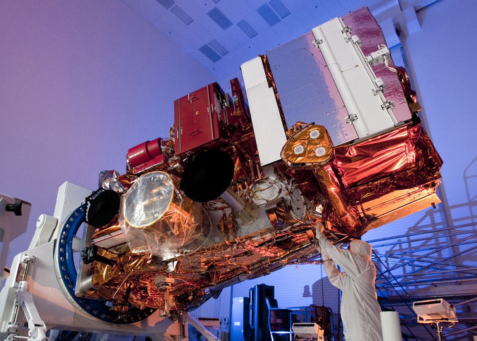
At a glance, GOES-18 appears identical to the first two satellites in the GOES-R series, but the cooling system for the satellite’s primary instrument is of a different design because of problems that arose shortly after the launch of GOES-17 in March 2018.
By April, mission controllers realized that the cooling pipe assembly for the GOES-17 Advanced Baseline Imager was “not transferring heat as it was designed to from the instrument electronics to the external radiator,” GOES-R program director Pam Sullivan says. The result? The camera’s infrared detectors weren’t staying cool enough to provide consistently clear images.
Operating adjustments were made so that GOES-17 could collect images, although with some limitations, in the GOES-West slot off the U.S. West Coast starting in 2019. NOAA later determined the culprit to be clogged filters within two 5-millimeter diameter aluminum cooling pipes.
With GOES-18 still in development at that time, ABI contractor L3Harris redesigned the cooling assembly to eliminate the filters. As of May, the tweaked pipe design on GOES-18 was performing well, Sullivan says, though the satellite is scheduled to remain in a checkout and calibration phase through December.
In the meantime, GOES-18 will be moved close to GOES-17 in June to assist with coverage from the GOES-West slot.
“We plan to deliver the GOES-18 ABI data to our users during the times when the GOES-17 ABI overheats due to the loop heat pipe anomaly,” Sullivan says. “That’s how it will assist GOES-17 before finally becoming operational.”
If all goes as planned, GOES-18 will become fully operational next year, at which time GOES-17 will be placed in on-orbit storage as a spare. — Jon Kelvey