Anyone with an inclination to do so can visit a NASA website and see daily images of Earth taken from 1.5 million kilometers in space, an idea first proposed by Al Gore when he was vice president.
The “DSCOVR: EPIC” website would go dark in 2018, if a Trump administration budget proposal succeeds. Among a set of cuts to NASA’s Earth Science work, the administration would end acquisition and processing of the images to save about $2 million a year.
Should Congress save the Earth Polychromatic Imaging Camera, called EPIC for short? The question is reviving old arguments over whether the camera has genuine scientific value, or whether it is at best a curiosity.
Gore during a 1998 speech at the MIT campus broached the idea of positioning a camera in deep space. He said viewing the entire Earth from a great distance would provide a “clearer view of our own world” that would bring “new levels of understanding” for weather forecasting, according to an article in The Tech, MIT’s newspaper.
It didn’t take long for Republicans to castigate the proposal, sometimes in colorful terms. In 1999, then Rep. Dave Weldon, R-Fla., called it a “multimillion-dollar screen saver” and “tripe science,” according to a June 1999 article in the New York Times.
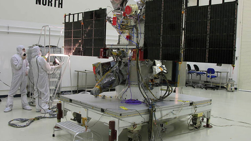
By that time, NASA and NOAA had expanded Gore’s single camera into a proposed multi-instrument satellite informally dubbed Goresat and formally called Triana. It was later renamed DSCOVER, short for Deep Space Climate Observatory. Republicans vehemently opposed the program, and the satellite was kept in storage during the George W. Bush administration, before being revived by the Obama administration and launched in 2015.
The concept of EPIC does have its fans in the science community. One of them is Jay Herman, who as project scientist for the satellite from 1998 through 2009 vetted the instruments for scientific value, and remains connected to the program as a research scientist at the University of Maryland Baltimore County.
Herman says EPIC has proved its scientific value since its launch in 2015, although not for weather forecasting as envisioned by Gore. Forecasting requires fast delivery of data, something that satellites closer to Earth are better suited for. He says EPIC is valuable for weather and atmospheric research, because it has 10 camera channels for measuring aerosol, ozone and cloud height.
“I was only involved because it has broad scientific value, it is doing unique science,” he says of EPIC.
In justifying its decision, the Trump administration pointed to a 2007 survey in which U.S. scientists suggested priorities for Earth science missions. At that time, the Obama administration had not yet revived the mission. The scientists did not include the mission among its list of recommended priorities, but said the satellite would have provided “innovative Earth and space observations from the L1 orbit but now sits in storage.” L1 refers to Lagrange point 1, one of the gravitational locations where a spacecraft can stay in orbit by expending little energy.
Where do things stand in Congress? Back in July, the Senate Appropriations Committee approved a bill that included continued funding for the Earth science projects targeted by the Trump proposal. In September, the House passed a spending bill that would cut $50 million deeper into Earth science than the White House proposal, but leaves the disposition of specific projects unclear.