
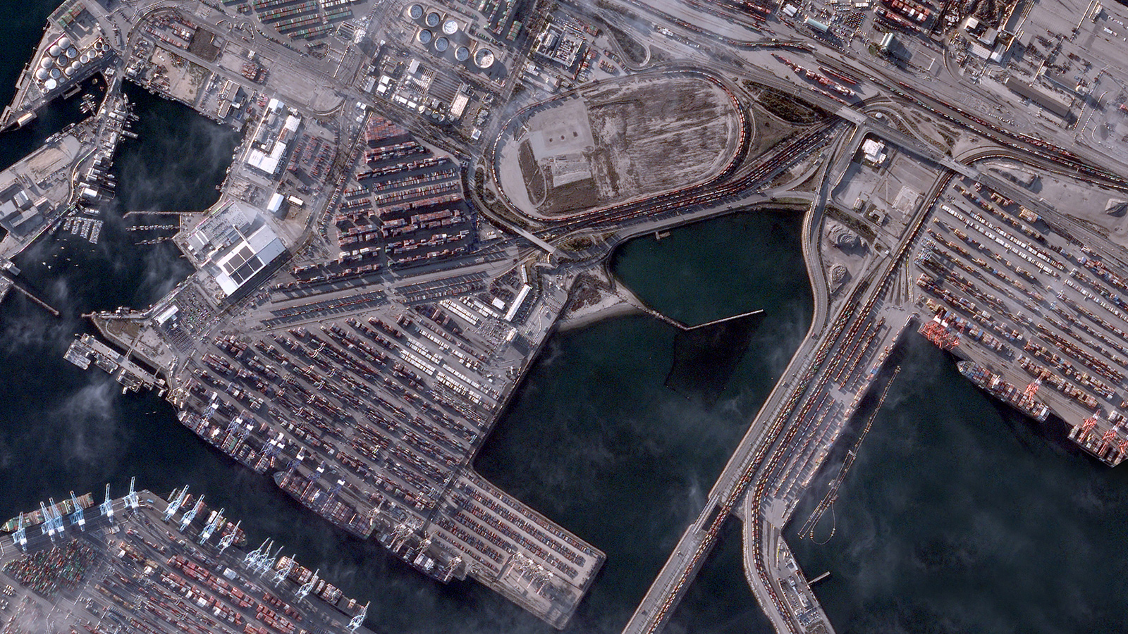
The Port of Los Angeles
Have you been waiting on a package that’s stuck in transit? BlackSky might know the reason why. This image was one of several captured when the Virginia startup directed its BlackSky 6 satellite to make multiple passes over the Port of Los Angeles. The spacecraft’s on-board framing camera snapped color pictures in 6-kilometer-by-4-kilometer swaths and at a fine resolution of 80 to 90 centimeters from an altitude of 450 kilometers.
Note the rows and rows of shipping containers: “You’re seeing the effect of everybody’s staying from home for the past year and realizing, ‘Hey, I need some gym equipment. Hey, I need a new monitor. Hey, my chair isn’t that comfortable’ and going to Amazon and other e-commerce sites and buying a lot of things,” says Patrick O’Neil, chief data scientist at BlackSky. The images document a “massive influx of consumer goods,” much of it still in shipping containers at the port, awaiting distribution, he says.
BlackSky is targeting its services toward the Pentagon and U.S. intelligence agencies, as well as companies looking to monitor their global supply chains, among other purposes. Raw images from each of the company’s initial seven satellites are downloaded and then an artificial intelligence algorithm, Spectra AI, sorts and analyzes the pictures for particular “channels,” meaning geographic locations, objects or kinds of activity. Customers request photos related to the channels in advance by visiting an online dashboard. Images are made available for viewing about 90 minutes after downlink.
BlackSky plans to launch an additional seven of the 55-kilogram satellites by year’s end, toward a total constellation of 30 satellites by 2023.
