
When imaging a ground target, the amount of detail a synthetic aperture radar satellite can depict depends in part on how long it can observe the target. One of the commercial leaders in the field, the Finnish company ICEYE, has nearly tripled how long each of its satellites can observe a target. ICEYE’s John Cartwright explains the history of its Dwell product inaugurated in May.
John Cartwright works in Denver as head of product for the data line of business of ICEYE, headquartered in Helsinki. He holds a Ph.D. in astrophysics from Caltech.
How do you spot military equipment in a dense forest on a cloudy day? How do you tell if a ship has moved in the last few hours and where it’s heading? These are the kinds of questions those in the defense and intelligence community are faced with every day as they endeavor to make strategic decisions to protect their people and their national interests in situations with otherwise sparse and imperfect information.
Nowhere is that truer than in Ukraine, a land with cloudy winters and millions of hectares of forests lush with pine, oak and beech trees. In the year and a half since Russia invaded, the country has also become the most high-profile example of the role of satellite imagery in executing security missions. Flooding from the Kakhovka Dam breach last month further demonstrated the importance of highly detailed imagery and rapid monitoring so decision-makers can understand the changes taking place on the ground and make better, data-driven decisions.
More help is on the way. I work for ICEYE, the Finland-based radar satellite operator and data provider. In May, we inaugurated Dwell, a new imaging product that was born from an experiment four years ago. This is the story of how we brought Dwell to market to address the need for a high density of detailed, actionable information delivered at a high frequency. It’s the latest innovation under our corporate mission of providing Earth observation data for risk mitigation, natural disaster response, infrastructure monitoring and defense and security, among other uses.
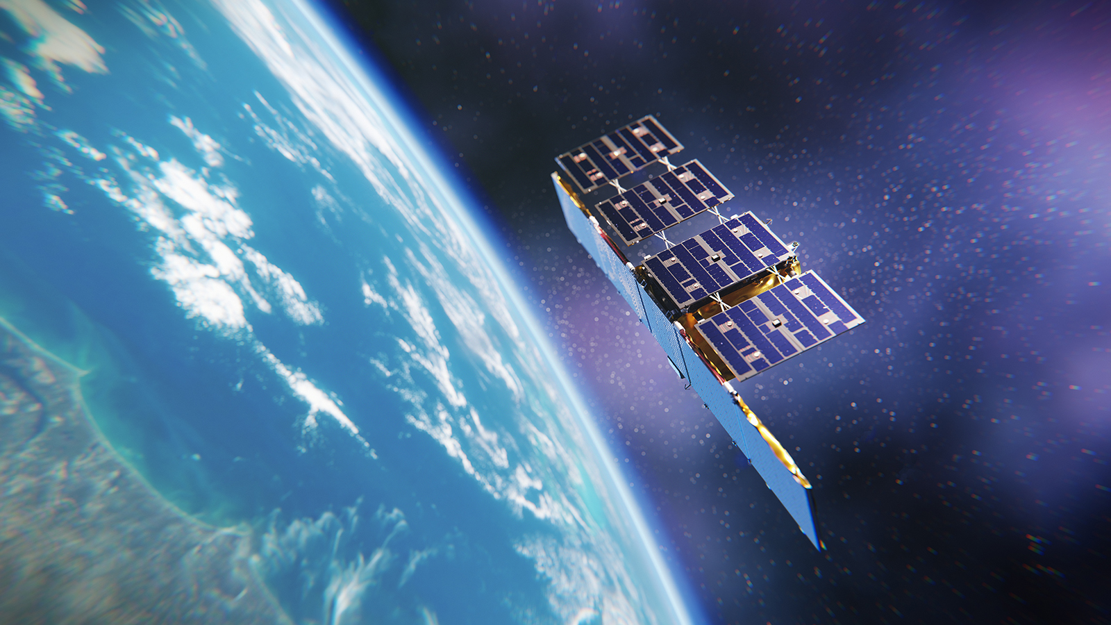
We maintain the world’s largest constellation of synthetic aperture radar (SAR) microsatellites, which provide persistent monitoring of locations anywhere on Earth in near-real time, 24 hours a day, in any weather. SAR offers a distinct advantage over traditional electro-optical imagery. While EO requires a light source to illuminate locations, SAR images are constructed by rapidly bouncing radar waves off the terrain so that the movement of the satellite creates the equivalent of a large camera aperture. Because radar waves pierce cloud cover, dust and smoke, SAR satellites can detect what is happening on land or sea, day or night, in any weather.
We have two dozen SAR satellites in orbit that can acquire and deliver images daily or subdaily. While previously our satellites could illuminate a specific location up close for 10 seconds, with Dwell we can now focus on an area for 25 seconds, giving much more insight into what’s happening on the ground in near-real time. This was achieved through the agility of our satellites, an adjustment of the aspect angle and the creation of a new SAR processor. As a result of the longer data collection time, we were able to develop data products that combine increased image fidelity with colorized imagery and video outputs — which previously didn’t exist in the commercial imagery industry.
The development journey
When we germinated the idea for Dwell in 2019, it was simply an experiment. We wanted to see what would happen if we shined the radar beam from one of our SAR satellites on one spot for a very long time. What could we generate from that data, and what would the functional applications be?
We started with a proof of concept just to see whether it was even possible. Early data was collected from a variety of locations, including an array of reflectors ranging in size from nearly 5 meters to less than a meter in Rosamond Dry Lake bed in California’s Mojave Desert.
Because our satellites are small and light, about the size and weight of a washing machine, we’re able to maneuver them easily with their electrically powered ion thrusters, and this gives us more control over the radar beam. Fuel constraints aren’t a concern, because the thrusters are powered by electricity derived from sunlight. Ultimately, 25 seconds struck a balance that provides significantly more data while still fitting within the space and ground segment capabilities of our constellation.
For some background on that, our satellites employ three main modes of image collection — Strip, Scan and Spot. Scan mode focuses on a 100-by-100 kilometer area and is useful for monitoring large-scale events, like searching for and monitoring maritime traffic on vast sea areas. Strip covers a 50-by-30 kilometer swath of the Earth. This mode is invaluable for activities such as monitoring icebergs for marine and maritime safety.
Spot zeros in on a 5-by-5 or 15-by-15 kilometer area, allowing for detection of objects as small as a set of tire tracks when two images acquired with identical geometry are compared. Our team recognized that finding a way to enhance the level of detail and visual acuity with a view this close up could be transformative for defense and intelligence agencies in the United States and other upstanding members of the community of nations.
Going from 10 seconds for a Spot image to 25 seconds of collection time for a Dwell image was no small feat. We had to physically rotate the satellite for a period of 25 seconds to keep it on target, while keeping it physically stable and to maintain focus. In the end, we built and installed an entirely new SAR processor on the satellite to utilize the reflected radar pulses at these extreme angles and efficiently process the approximately 20-times-greater amount of data.
The development process moved slowly by our standards because we had to ensure we could produce and deliver product rapidly enough to meet our partners’ needs. Decisions must be made quickly in defense and intelligence; it doesn’t take long for intel to become too stale to be of much use. We also had to make sure we had the capacity in place to provide the end product at scale. Our satellites can be upgraded during their entire operations life cycle, so we’ve been able to implement Dwell mode on spacecraft already in space. Our ground terminal network, backhaul, ground systems and distribution systems can all handle the heavier data weight of the Dwell product.
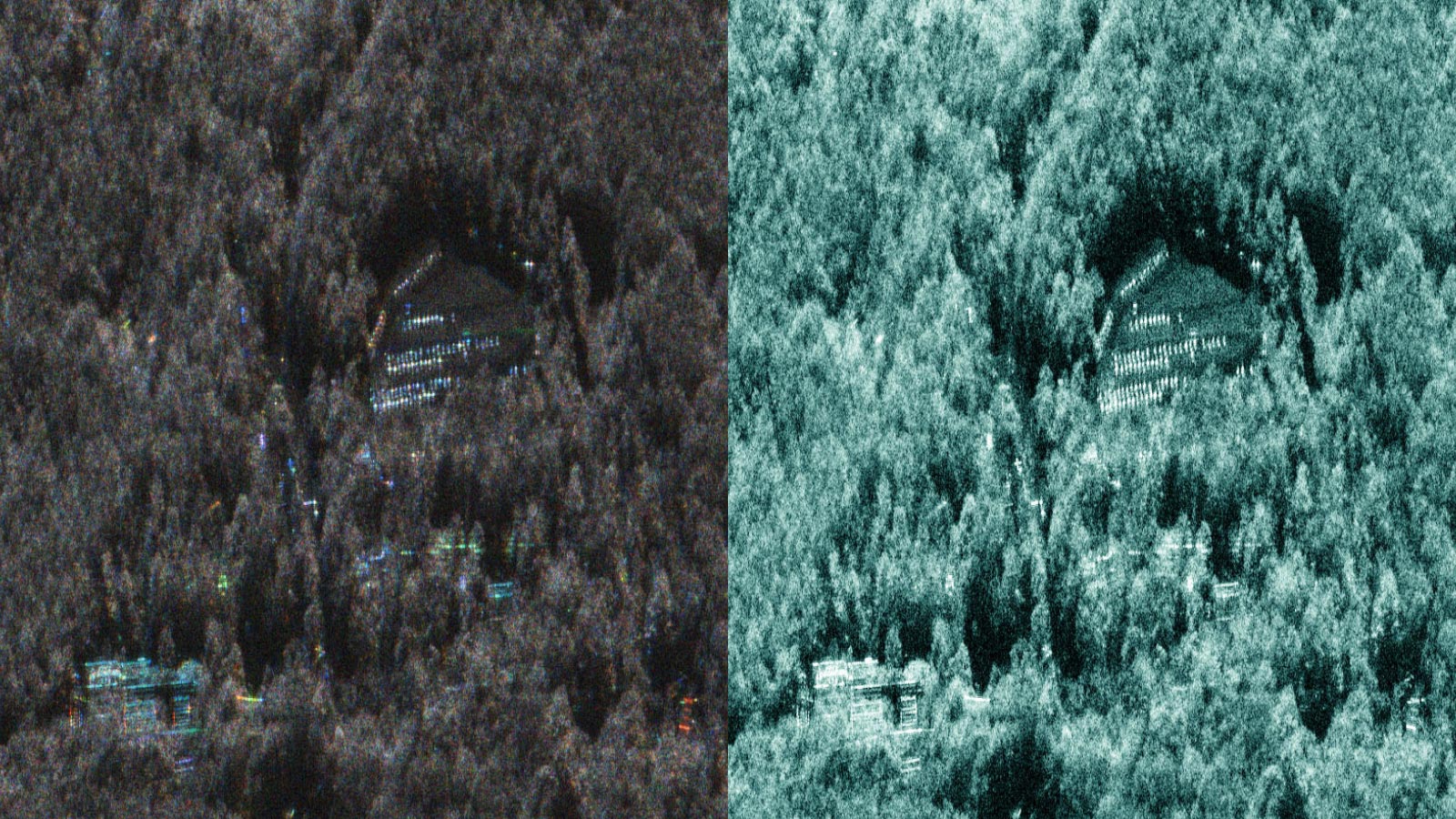
Along the way, we continued to refine Dwell, calibrating and validating the data on test areas. We were thrilled by the amount of information gained from a single satellite pass and how exceptional the level of detail was. Individual gravestones in a cemetery appeared from beneath a forest canopy. Objects as narrow as a power line popped out easily from the trees.
Clarity, color and video
The result is a bundle of three components. The Amplitude product significantly reduces the speckle that makes images appear grainy by integrating numerous independent looks into a multilooked product. Now analysts can more easily interpret what they’re seeing and classify objects with more confidence. We can distinguish between a bulk cargo ship and an amphibious assault ship. What once would’ve been an indeterminate aircraft is now an SU-35 fighter jet.

The Color Sub-Aperture Image product distinguishes human-made objects from the natural environment. Objects with human-made features appear brightly colored in images, with differences in colors indicating different reflection angles — versus natural backgrounds, which tend to be rendered in gray in the Color Sub-Aperture Image component of the Dwell bundle. This not only makes objects stand out from between trees and other natural cover, but it also helps differentiate between large single objects like buildings and clusters of smaller individual objects like military vehicles.
The Dwell data is processed into multiple image frames. Similar to animation, these images are overlapped and stacked to create a video, the third component of the Dwell bundle. This video capability allows for monitoring of movements and tracking of behavior patterns. Analysts can track the motion, heading, velocity and speed of land vehicles and marine vessels. Bright reflections of human-made objects pop through dense forests.
Our team released a preview of the forthcoming video capability at the Satellite 2020 Conference & Exhibition in Washington, D.C. Sample videos of Heathrow Airport in London, the Bingham Canyon mine in Utah, a port in Busan, South Korea, and the bustling cities of Las Vegas and Tokyo highlighted the broad applications of Dwell for detecting and monitoring human-made moving objects like motor vehicles, airplanes, helicopters and aquatic vessels.
We began our pilot phase with a few customers in March 2021. The feedback we received was overwhelmingly positive. It was immediately clear that the product filled a critical need for our partners.
Launching the future of SAR
We launched Dwell during the GEOINT Symposium in St. Louis in May so that we could share it with the broader geospatial intelligence community. We’re collecting Dwell images daily for our customers now.
There’s still much more we hope to do with Dwell as we continue to explore the possibilities of SAR technology. There is potential to collect data for even longer durations. We are working on developing new imaging modes and exploring other capabilities to expand our offerings. In June, we launched four more satellites that will further add to Dwell’s capabilities.
Demand for more advanced Earth observation and change-detection products is growing — the events of the last 18 months have made that clear. Last August, we partnered with the Government of Ukraine to provide SAR satellite imaging capabilities and help fulfill its need for objective data and technological support.
Space technology and innovation — once led by a handful of the world’s governments — is now driven by commercial companies large and small. ICEYE moves quickly, with both new generations of spacecraft and also rapid advances in processing technology, to respond quickly to customers’ needs with innovative new products. Our aim is to continue developing reliable, timely solutions that burst through the barriers of conventional imaging. As the new space industry grows and evolves, it will expand the limits of what’s possible, be ready to meet moments of global consequence and change the way we look at our world from space.
