Stay Up to Date
Submit your email address to receive the latest industry and Aerospace America news.
The Digital Avionics Technical Committee advances the development and application of communications, navigation and surveillance systems used by military and commercial aircraft.
This was a year of progress for unmanned aircraft avionics, due in part to actions of RTCA, the standards association founded in 1935 as the Radio Technical Commission for Aeronautics. Special Committee 228, which focuses on Minimum Operational Performance Standards for Unmanned Aircraft Systems, in May published two related documents. The first, “Detect and Avoid Minimum Operational Performance Standards Phase 1,” designated DO-365, addresses the FAA requirement for “see and avoid.” The standard defines the necessary self-reporting for a UAS, as well as when to provide the pilot in command with the information needed to take corrective action.
Validation of performance requirements for DO-365 was supported by the Integrated Flight Test Series 4 in 2016 involving NASA’s Ikhana unmanned aircraft. Various types of intruder aircraft were used, including King Airs, a T-34, a Gulfstream 3 for high-speed encounters and a TG-14 slow, low-radar cross section.
DO-365 and a second document, “Minimum Operational Performance Standards for Air-to-Air Radar Detect and Avoid Systems Phase 1,” join DO-362 “Command and Control Data Link Minimum Operational Performance Standards (Terrestrial)” published in September 2016. Together, these documents represent the world’s first set of standards that the FAA will invoke for UAS integration into the U.S. National Airspace System.
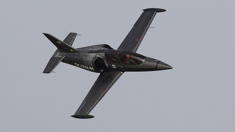
A team from the Czech Technical University in Prague in February began integrating a precise synthetic vision system into a ducted fan UL-39 ultralight jet with a precise altitude difference measurement system. The goal is to test the suitability of these systems for installation on unmanned aircraft. This altitude determination system improves long-term stability of the microelectromechanical system, or MEMS, sensors for airplane orientation measurements. The system also uses a new method of determining position angles based on precise determination of the pressure differences in areas of the airplane. This is a new kind of information for data fusion within navigation algorithms. In early 2017, the team received altitude data from a stratospheric balloon equipped with the altitude measurement system. The balloon was flown under the European Space Agency’s Balloon Experiments for University Students, or BREXUS, program.
In 2016, a flight of the altitude system was conducted on a general aviation aircraft and, in 2015, on an unmanned aircraft. The pressure difference measurement system evaluated in the flight tests provides altitude differences was found to work perfectly in static conditions in which the altitude difference can be measured with precision of plus or minus 10 centimeters. This result is important for the terrain-mapping technologies in which the vertical difference provided by GPS is not precise enough. However, wind gusts and temperatures degrade measurement and require further investigation. The findings provide a novel way for terrain mapping that requires precise measurements of small vertical differences. The same technology was used for orientation measurement onboard different flying vehicles. These testbeds were used: a laboratory setup, a small UAV with 2-meter wingspan, a general aviation airplane and a stratospheric balloon.
Contributor: Erik Theunissen
Pavel Paces teaches at the Czech Technical University in Prague.
Related Posts
Stay Up to Date
Submit your email address to receive the latest industry and Aerospace America news.


