

The U.S. Office of Space Commerce is facing a deadline of late 2024 to have in place the initial software and people to take over tracking of debris and civilian spacecraft from the military. Is OSC moving fast enough? Jon Kelvey tells the story.
The window of the Soyuz spacecraft afforded a view of the dark of space. Somewhere out there was the reason the three crew members of the International Space Station had hastily floated into their docked lifeboat and sealed the hatch. The space station and a piece of debris — possibly from a 1993 rocket launch — were closing in on each other, and NASA mission control had declared a red conjunction to the crew, meaning there was no time to move ISS out of danger. They would need to take shelter.
Back in Houston months later, “I learned that the orbital path of an old payload assist motor had been incorrectly calculated, and it was much closer to ISS than indicated by data from the catalog maintained by the U.S. Air Force,” recalled Sandy Magnus, then a NASA astronaut and one of the crew, in an article last year in Aerospace America. If the debris pierced ISS badly enough, the station would depressurize, suffocating all aboard. So the trio in the Soyuz waited to learn whether they would need to jettison away from the orbiting lab whose construction NASA contributed $60 billion to. Luckily, the fragment passed ISS by 4 kilometers.
This 2009 incident was not a one-off event. A similar case of a red conjunction unfolded in 2021 when debris from a Russian anti-satellite weapon test sent the crew of seven rushing to their lifeboats. Again, the debris passed by harmlessly. In cases where there is enough warning, ISS is maneuvered to keep the debris out of a safe zone around it. That’s because astrodynamicists can’t predict with absolute certainty whether two objects will collide or miss each other. For this reason, ISS has been maneuvered upwards of 30 times since 1999.
While space is a big place, it could be just a matter of time before luck runs out not only for astronauts and cosmonauts, but also for operators of satellites and the millions of us who rely on satellites for communications, weather data, scientific readings, navigation photos and other services.
“There’s a real question in my mind about how much time we really have,” says space entrepreneur Kevin O’Connell.
O’Connell hasn’t been the only one worried. In 2018, then-President Donald Trump signed Space Policy Directive-3, instructing the U.S. Department of Commerce with setting up a civilian space object tracking program for commercial satellites, while the military focuses on its own.
For a while longer, the job of tracking civilian objects and sending conjunction alerts will remain in the hands of Space Force personnel (formerly Air Force) in operations centers at Vandenberg Space Force Base and the Naval Support Facility in Dahlgren, Virginia. The Commerce Department’s Office of Space Commerce, though, is preparing to take on the civilian role.
For OSC, the year has been an active one of outreach to industry and planning to meet a goal of having the initial version of new tracking software and operations centers in place by September 2024. Former astronaut Magnus is the acting program manager and chief engineer for creation of this Traffic Coordination System for Space, or TraCSS. Needed will be a suite of software to display numerical and graphical representations of trajectories on computer screens for civil servants. They will take over the job of warning commercial and civilian government organizations of potential collisions. At first, tracking the civilian objects will continue to be done mainly with ground telescopes and radars operated by the military, but plans call for OSC to gradually wrap in commercially operated services.
“What we’ve planned is a very slow change from the commercial industry receiving data from the DoD over to TraCSS in a way that does not disturb current operations and allows everyone to get comfortable,” Magnus said in a July video update posted on the OSC website.
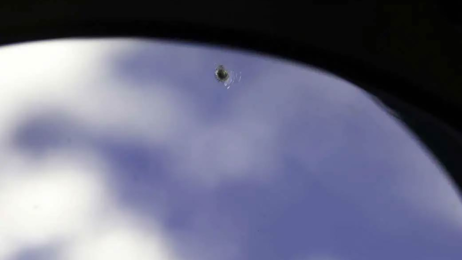
Space, especially low-Earth orbit, has become a complicated place since 1957, and it is becoming more so at an accelerating pace. Some 8,900 active satellites orbit Earth, most of them in LEO, where ISS and China’s space station orbit. They do so among an estimated 35,000 pieces of tracked debris ranging in size from 10-centimeter-long metal fragments to entire satellites, old rocket motors and discarded rocket stages and fuel tanks. Satellite operators regularly have to decide whether to expend precious propellant to maneuver out of the way. And the numbers are only projected to grow as megaconstellation operators add more satellites. SpaceX’s Starlink constellation alone numbers some 4,800 satellites and is growing, with near-weekly launches of between 20 and 50 satellites.
This year, OSC has done the following: issued a request for information from the commercial space industry on what services TraCSS should offer; held industry days and workshops; posted the explanatory video on the OSC website; and awarded one contract for cloud computing hosting for TraCSS. So far, no software code has been written nor figurative metal bent. And while Magnus and OSC Director Richard DalBello have said they are taking a “crawl, walk, run,” approach to developing TraCSS, moving in deliberate phases to avoid causing any space traffic accidents, not all are convinced there’s time to crawl and walk.
“Why are you crawl, walk, running when you already proved through [a pilot program] that you have something that works?” says Paul Graziani, the founder of space and military software company Analytical Graphics and now the CEO of the Commercial Operations Center, or COMSPOC, a Pennsylvania company that tracks satellites and debris.
He’s referring to an OSC pilot program in late 2022, in which commercial companies including COMSPOC demonstrated that they could perform aspects of the TraCSS mission. So in his view, OSC’s approach to developing TraCSS amounts to “spending more money delaying the capability.” Whereas if the office contracted with companies like COMSPOC, “you could turn it on and go and have the function immediately.”
Another expert concerned about the pace is O’Connell, who directed OSC from 2018 to 2021 and began conceptualizing what’s now called TraCSS.
“My worry is we’ll have a major crash in space,” he says.
After all, it’s happened before.
A month before Magnus and her crewmates had to take shelter, an operational Iridium communications satellite was crossing over Siberia in LEO, as was Cosmos 2251, a defunct Russian military communications satellite. The two collided, generating 2,000 pieces of debris larger than 10 centimeters, at least some of which won’t naturally deorbit before the end of the century, according to a NASA analysis. Magnus’ close call had nothing to do with debris from that collision, but two years later, ISS maneuvered to avoid a piece of the Cosmos-Iridium debris. Iridium said it received no alert in 2009 before the collision.
Both satellites were spotted and tracked by the U.S. Space Surveillance Network, consisting mainly of ground radars and telescopes, plus some satellites. They were in the Air Force’s catalog, but reportedly no human at the Vandenberg operations center responsible for monitoring the network had conducted a conjunction assessment, an analysis of the satellites’ orbits, to see if they were at risk of colliding.
“They were only screening a smaller list of critical government payloads at that time,” says Brian Weeden, director of program planning for the Secure World Foundation and who from 2004 to 2007 tracked space objects as a U.S. Air Force officer.
Following the collision, the Defense Department expanded its conjunction assessment screenings to include all operational satellites, publishing their ephemerides (position coordinates and velocities over time) on its existing space-track.org website.
Currently, there are about 47,000 objects in the catalog, now overseen by U.S. Space Command, and conjunction assessments are made by the Space Force’s 18th Space Defense Squadron at Vandenberg and its sibling squadron, the 19th Space Defense Squadron, at Dahlgren. Conjunction alerts are sent automatically.
“Today, if you are a company that operates a satellite or you’re a foreign government operating a satellite, you will occasionally get an email from the U.S. government that says, ‘Hey, your satellite X is predicted to come close to another space object in let’s say, three days from now,’” Weeden says. “There’s a one in 8,000 chance it’s going to collide.”
Back in 2011, the Secure World Foundation published an analysis highlighting some possible drawbacks and limitations to this approach. For instance, the position and velocity information for objects available on space-track.org was not as accurate as it could be. In the case of the Iridium and Cosmos satellites, they were predicted to pass within 600 meters of each other instead of colliding.
“The DoD computer systems and software to do this are ancient, and they are struggling to upgrade them,” Weeden says. It’s also not ideal, he adds, for the military to share space object tracking data collected with the same sensors with which it keeps tabs on classified military satellites and potential nuclear missile launches. “They have all this classification, all this national security stuff; they’re not the right entity to be doing this.”
The Obama administration seemed to agree. An interagency policy committee discussed moving the responsibility for tracking civilian and commercial space objects to a civilian agency within the Department of Transportation, and this idea was picked up by the Trump administration in 2017. The result was SPD-3, which states that as the number of objects in space increases, the “limited traffic management activity and architecture” of the military’s space tracking facilities will “become inadequate.”
“To maintain U.S. leadership in space,” SPD-3 states, “we must develop a new approach to space traffic management (STM) that addresses current and future operational risks.”
No one believes it will be easy.
“Commerce is being asked and tasked to do a lot of stuff, and they are starting from scratch,” Weeden says. “And then, how do they enhance it? Because the whole point of this exercise was not just to replicate what the DoD is already doing, because we know that’s already not good enough.”
OSC won’t be building its own surveillance network. Instead, TraCSS will begin operations with unclassified tracking data from the Space Surveillance Network, with the goal of relying more and more on commercial tracking companies over time. OSC will also hire its own civil servants to conduct the conjunction assessments for TraCSS based out of two operations centers, one primary and one backup, according to a presentation DalBello made in September at the Advanced Maui Optical and Space Surveillance Technologies, AMOS, conference.
“We haven’t chosen those locations yet, but we’re starting that staffing process,” he said. “It’s a complicated process, but our goal is next year, in 2024, to have a staff of about 50.”
One of those roles will be a permanent program manager for TraCSS, with Magnus continuing to serve as chief engineer, DalBello added. The hiring process was helped along by OSC receiving a $70 million budget for fiscal year 2023, up from $16 million the year prior.
OSC will eventually take over space-track.org, though what changes will be made to how the website looks and what information is displayed is not yet clear. According to remarks by Magnus in the July OSC video, the TraCSS operation centers will screen for conjunctions twice as often as the military — every four hours instead of every eight. Eventually, commercial users will be able to pull whatever alerts or notifications they need directly from the TraCSS software into their own computers, rather than looking out for warning emails.
Software, in addition to OSC staff, will be the heart of TraCSS, divided into three main components: The TraCSS-OASIS database will ingest and hold all the space tracking data, whether from the military or private contractors. TraCSS-SKYLINE will host the user interface and any commercial third-party software OSC purchases to provide services for users. Lastly, TraCSS-HORIZON will serve as a mirror of the operational TraCSS software, a sandbox for testing new capabilities before integrating them into operations.
In mid-August, OSC contracted with Amazon Web Services to provide hosting for all the TraCSS software, DalBello said at AMOS. Plans call for OSC to select a systems integrator to connect the different pieces of the TraCSS software and hardware, and later a contractor to build the user interface, though the office declined to say when those requests for proposals will be published.
The plan is to roll out TraCSS in three phases, with phase one beginning in late 2024. The first TraCSS conjunction assessments and other information about the orbits of space objects will be posted to space-track.org as conjunction data messages. OSC will fix any bugs and build out the user interface through the end of 2025.
“Then we’ll move on to phase two, which will be the launch COLA [collision avoidance] phase,” DalBello said at AMOS, which will require coordination with FAA. “And then phase three will follow that, where we’ll look at the issue of reentry and management.” He did not give a timeline for the completion of these phases.
That is the TraCSS plan, but the actual action, so far, has been mostly planning. There was the RFI published in January, and multiple industry workshops held since then, but the only procurement has been the cloud computing services contract in August.
“The workshops are good for engagement, but at some point, there’s enough talking and there’s got to be doing,” says space environmentalist Moriba Jah, an associate professor of aerospace engineering and engineering mechanics at the University of Texas at Austin and chief scientist at the space sustainability company Privateer. “To me, a signal of change, of real change, is when space-track.org closes its doors, and it’s space-commerce.org,” he says, suggesting a potential domain name for an OSC-run space tracing website.
They needn’t wait to get the TraCSS operations centers going but could simply port the existing space-track.org information to a new website, Jah adds, because “that shift alone, going from the military to something civil, already sends a positive signal to the globe.”
Meanwhile, Graziani of COMSPOC worries that reliance on legacy military software could bog TraCSS down. TraCSS will start off using a software called Astrodynamic Support Workstation, but “that’s late ’80s and early ’90s technology,” Graziani says. “The DOS operating system, essentially, is what they’re trying to use in today’s world.”
When asked, OSC Special Adviser Christine Joseph said the plan is to use ASW temporarily in order to decompress military file formats and port that information into TraCSS Oasis.
Graziani and Weeden also point out that in developing OASIS, SKYLINE and HORIZON, the office will need to show it can do better than the Defense Department has in the multiple attempts to develop replacements for its own software like Astro Standards Workstation: An April report published by the U.S. Government Accountability Office calculated that the military spent $1.7 billion between 2000 and 2022 on attempts to replace out-of-date software. Weeden rattled off a long list of these failed attempts:
There was the Cheyenne Mountain Upgrade attempt from 1981 to 1998, and the Combatant Commanders’ Integrated Command and Control System attempted from 2000 through 2008.
From 2009 to 2012, there was the new Joint Space Operations Mission System, JMS, and 2012 to 2018 an attempted reboot of JMS.
JMS was terminated in 2018, and the military launched Space C2. In 2019, Space C2 was joined by the Enterprise Battle Management Command and Control program and another “agile software development program.”
In 2022, a contract was awarded for the Advanced Tracking and Launch Analysis System, which appears to be a replacement for SpaceC2.
The problem, Graziani says, is that the government procurement process simply moves too slowly to keep up with the changing requirements of sophisticated software. “Moore’s Law turns over every 18 months,” he says, referring to the doubling of the computer power of microprocessors. Therefore, by the time contracts roll three to seven years after the start of a program, the end product is already obsolete.
The solution, in Graziani’s opinion, is to better harness the private sector. He argues that companies like his own COMSPOC, Slingshot Aerospace and ExoAnalytic Solutions already demonstrated the ability to meet the requirements of TraCSS during the 2022 pilot program.
At the very least, OSC could do more pilots and experimentation with private companies now, says former OSC director O’Connell, before taking full responsibility for civilian and commercial space tracking from the military.
“Why are we not taking advantage of that as a great opportunity to experiment very much with what is going on in industry, to try different things, to aggressively experiment as opposed to relying on traditional processes for acquiring capabilities?” O’Connell said during a panel at the AMOS conference. “I worry that we’re still being too cautious in our bureaucratic processes, given the demand.”
Asked about Graziani’s argument that OSC could simply contract with commercial space companies to begin offering space traffic and situational awareness services through TraCSS sooner, OSC provided a statement by email: The pilot program in geostationary orbit “did highlight that, in the GEO regime, commercial SSA companies can play a key role in the implementation of TraCSS,” but that “the findings also emphasized the need for transparent metrics around evaluating SSA data and services.”
The statement also noted that OSC, which was created in 1988 to foster the commercialization of space activities, has always been “a primary proponent of the policy that the government should not compete with industry, and should buy commercially available goods and services to the maximum extent practicable. In the TraCSS program, we are going to practice what we preach.”
O’Connell understands the task before the current OSC civil servants and hopes they succeed. But he still suggests time may be one of the more limited resources in the whole enterprise. Too much delay not only could lead to tragedy in space but could also be a blow to the future of the commercial space economy.
“I really worry about a day when there’s a terrible crash in space, at which point everyone will come out of the woodwork with their own well-intended idea about what to do about it,” O’Connell said at AMOS. “And if this community does not have the loudest voice, and that is based on scientific data, best practices, etc., we’re going to be in trouble.”
