Stay Up to Date
Submit your email address to receive the latest industry and Aerospace America news.
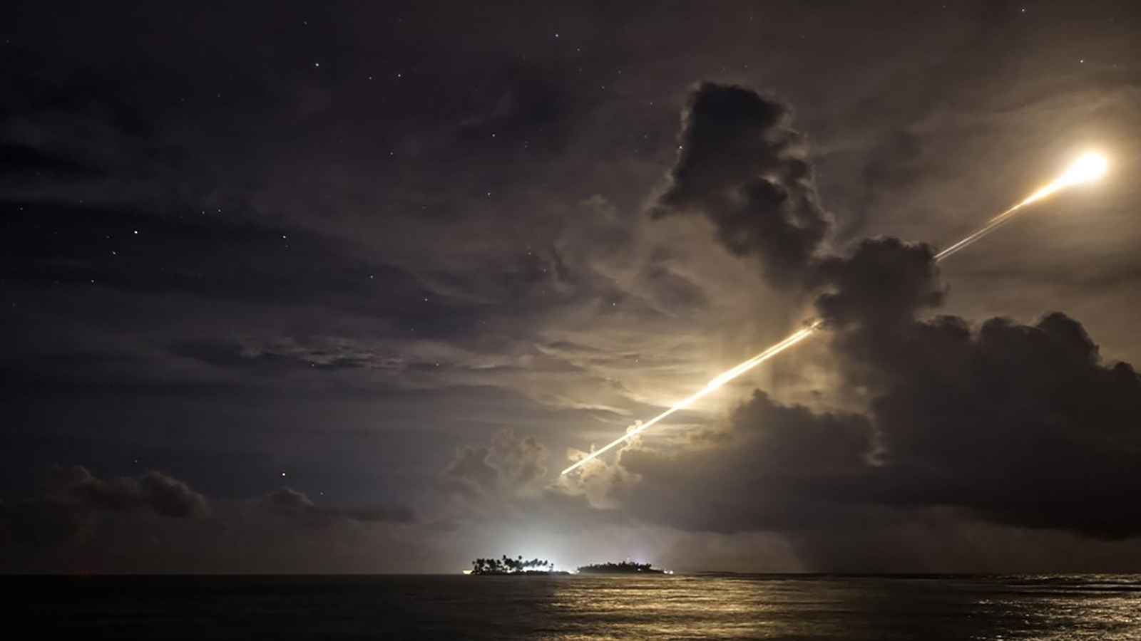
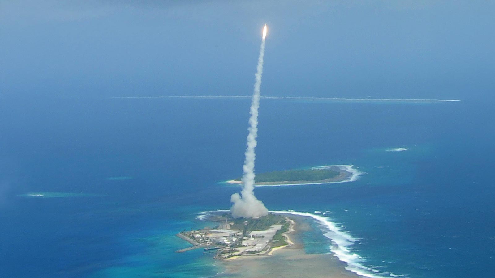
The highest point on the Kwajalein island chain, home to the Ronald Reagan Ballistic Missile Defense Test Site, is Mount Olympus. Rising 17.5 meters above the Pacific Ocean, it illustrates a big problem facing the U.S. military: Arguably its most vital missile, hypersonics and space surveillance venue is uniquely vulnerable to the rising seas of climate change. Is it feasible to keep Kwaj running? We spoke to two U.S. Army colonels whose mission is making sure the answer is "yes."
The waves knocked down doors, upended furniture and tipped over bookshelves, leaving flooding in its wake and an unspoken question: Is this the future?
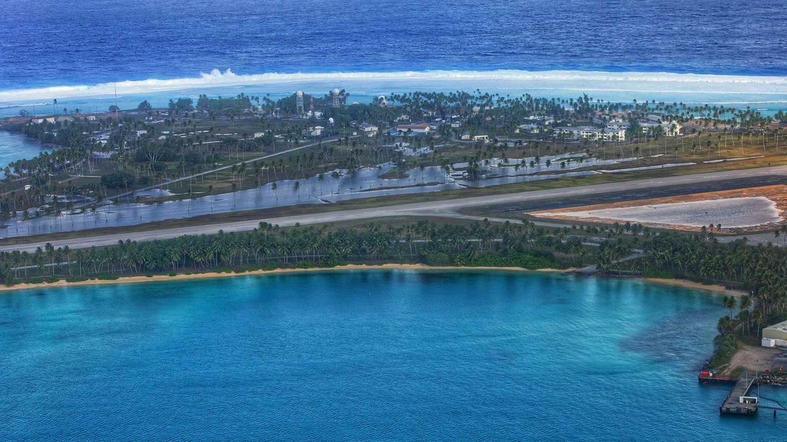
The scene was January 2024 on the island of Roi-Namur, the second largest among the 100 slivers of land that form Kwajalein Atoll in the Pacific Ocean, an oblong ring of islands 1,100 kilometers north of the equator. About 120 U.S. military personnel and contractors live and work on Roi-Namur to run its rocket launch pad, radars and telescopes. This island is about the quarter the size of Key West and is home to the majority of surveillance equipment within the Ronald Reagan Ballistic Missile Defense Test Site, which comprises 1.9 million square km of ocean and multiple missile launch sites on various islands.
“Kwaj,” as military people call the atoll and the surrounding test range, is a focal point for U.S. missile defense testing and the surge of hypersonic weapon experiments that the U.S. has embarked on to try to catch up to China on the technology.

“Because it is so wide open, it allows us to test without having the fear or the risk of causing any damage to personal property, infrastructure, personal land or any injury to people,” Army Col. Juan Santiago, who directs the Reagan Test Site from Redstone Arsenal in Huntsville, Alabama, tells us.
Also, the atoll’s position near the equator puts its telescopes and radars in the closest possible proximity to satellites positioned high over the equator in the geo-belt. In particular, U.S. officials view the Millimeter Wave Radar on Roi-Namur as one of the finest-resolution imaging radars in the world, perfect for “space object identification,” according to a 2012 article in the journal of the MIT Lincoln Laboratory. The atoll is also well-positioned for getting an early look at Chinese missile and weapon tests over the Pacific.
The tradeoff is the watery surroundings 7,000 km from Australia and 8,000 km from the continental U.S. Kwaj is literally in the middle of the Pacific Ocean.
“This is like the space station. It’s remote and isolated and resupply is not frequent and not assured,” Army Col. Andrew Morgan tells us. As a NASA astronaut who spent nine months on the International Space Station in 2019 and 2020, he should know. Morgan is now commander of U.S. Army Garrison-Kwajalein Atoll on Kwajalein Island, the atoll’s largest island, about 80 kilometers from Roi-Namur and half as big as Key West. Kwajalein Island is less desolate than Roi-Namur. About 1,300 personnel are stationed there, including their spouses and children who attend the one school with two campuses for various ages.
An assignment to either island is a unique experience. “Under any circumstances, it’s a difficult place to work and operate because of its remoteness and its austerity, but also the environmental conditions that it’s located in,” Morgan says.
The flooding of Roi-Namur underscored what scientists have contended for years: that such events are indeed the future for low-lying places such as Kwajalein as seas continue to rise due to climate change. Roi-Namur’s average elevation is 2 meters, and its highest point, Mount Olympus, is a 17.5 meter tall artificial hill with a rocket launch pad on top.
The climate threat to Roi-Namur and the rest of the Reagan Test Site has arrived just as China is making inroads in space and on hypersonic weaponry, and the atoll’s facilities may be needed most by the U.S.

On Roi-Namur, seawater poured through the bachelor quarters, rendering air conditioning units worthless, disrupting power distribution and wreaking havoc on the dining facility. The Army promptly evacuated 80 of the 120 personnel who live on the island and began “Operation Roi Recovery,” a months-long cleanup effort.
The proximate cause of this damage? A cyclone that formed days earlier near Japan and moved eastward. The sea under the storm rose to meet the lower pressure above, where powerful counterclockwise winds whipped up waves that radiated outward and settled into rolling swells. The storm came no closer than several hundred kilometers to Kwajalein, but shortly after the sun set last Jan. 20, the swells met the shallows on the north side of Roi-Namur, morphing into 4.5 meter tall waves that crashed into the northernmost point of the atoll for about half an hour.
Storm-driven waves are of course an entirely natural phenomenon. But from 1990 to 2020, the seas around the atoll rose 11 centimeters, as measured by Europe’s altimeter-equipped Sentinel satellites. This, says coastal scientist Curt Storlazzi, made the damage worse, and is just the start of what faces the atoll in the years ahead. Up to 20 cm of additional sea level rise is forecasted by the United Nations’ World Meteorological Organization through 2050.
When that happens, it won’t take a cyclone as strong as last year’s to do lots of damage. “Now, a smaller wave with shorter periods can run as far inland as a much bigger storm with bigger waves and longer periods did when sea level was lower,” explains Storlazzi, of the U.S. Geological Survey. He has analyzed flooding of the atoll going back to 2008.
And so, the clock to reimagine the islands’ infrastructure is ticking. A 2018 study led by Storlazzi predicted that seawater would soak into Kwaj’s already brackish groundwater, making it too salty for the existing water treatment plant to render it drinkable through reverse osmosis. The saltwater intrusion will mean no potable water by 2035, Storlazzi and his teammates predicted in a report for the Defense Department, “The Impact of Sea-Level Rise and Climate Change on Department of Defense Installations on Atolls in the Pacific Ocean.”
Morgan, the garrison commander, has an idea. “It’s a highly humid environment, so there’s a lot of water stored in the air, and we can collect that,” he says. He’s referring to water reclamation, in which water is extracted from the ambient air to produce potable water.
In addition, DARPA has funded research through its Atmospheric Water Extraction program to develop small, lightweight, low-powered, distributable systems for the daily needs of roughly 150 people. The roughly 1,400 people on Roi-Namur and Kwajalein Island consume 20 million liters of water a month, according to Army budget documents.

An ever bigger issue lurks, however. By the most optimistic calculations, in 85 years Kwajalein’s islands will flood so regularly that operations there would be impossible. There will be some mitigating effects from the changing climate, namely slightly lower wave heights on average in deep waters, slower wind speeds and less frequent typhoons. But these “will likely be insignificant in comparison to the impact of projected increases in sea level in the region.”
Take a scenario in which the sea level rises 40 centimeters. In that case, at least half of Roi-Namur would be flooded by the distant effects of a storm like the one last January. And during these floods, more infragravity waves could hit the shoreline. These irregularly shaped waves formed by the wind can rise to several meters and exacerbate flooding. In addition, warmer water means more coral bleaching events, in which the individual coral polyps expel the algae that nourish their cells and gives them their color. This means smoother reefs that allow more runup and flooding from waves.
It’s challenging, but Morgan and Santiago aren’t in their roles to give up on Kwajalein. The atoll is “an ideal place to demonstrate climate resilience,” Morgan says. He has a message for senior Pentagon and service leaders who visit, “Let’s make this the Epcot Center for Climate Resilience, for the Army, for the Pacific, for the DoD.”
Among the possibilities: studying new paints and coatings that could be applied over existing paints on radar components to reduce rusting. Morgan says Kwajalein is well-known for its “highly corrosive sea spray that devours any sorts of metal and even plastics after a time.” Unlike a Navy cruiser, Kwajalein can’t be taken into dry dock for a season and re-emerge sparkling.
Another option would be to modernize the radars.
“We can go from analog to more digital, more of a digital footprint,” explains Santiago. “And so what that’ll help us do is reduce the components and parts that we have to keep on hand that, again, are also challenging, because you have to maintain those in a climate-controlled environment so that those spare parts don’t rust.”
Also, where applicable, structures could be rebuilt away from the most flood-prone areas and made so they stand a meter or so higher than the projected sea level rise. Already, housing on Roi-Namur is located on higher ground than other parts. (The 2018 report notes how cameras installed there as part of another study stopped working because water ruined the batteries.)
The Army’s fiscal 2025 budget request and five-year spending plan proposes spending roughly $2.2 billion to operate the site during that period. That includes at least $1.2 million in fiscal 2025 for research on mitigating climate risk.
The first half of 2024, though, was a race to get Kwajalein back in shape. As many as 10 launches of ballistic missiles or hypersonic weapons occur from the atoll each year. A test of unarmed intercontinental ballistic missiles in February had to be rescheduled, but in June, the team on site conducted three tests that month. U.S. leaders refer to Kwajalein as the premier place to test hypersonic weapons.
On Roi-Namur: “We haven’t been able to get back to rebuilding the chapel or rebuilding the outdoor theater, because those just have not been priorities relative to getting bachelor quarters and dining facilities and radar systems and runways up and running,” Morgan says. “Anytime you flood a building, of course, that means that you’re going to have to gut it.”
He adds: “Overall, it’s a little bit of a quality of life setback. Certainly, the sense around here is that it’s going to be a long time before we ever get back to even where we were, let alone better than where we were.”
But looking long-term, he is upbeat, despite the warning shot and predictions of further sea level rise.
“Kwajalein’s best days are still ahead of us,” he says. “Our leaders recognize Kwajalein is important and it was in a fragile state, and that we’re going to need to reinvest in it heavily to get it back recovered, and need help to achieve its full potential over the next decade or two. Because it’s important now — It’s more important now than it has been in many decades.”
About Mike Gruss
Mike freelances from northern Virginia. Previously, he was editor-in-chief of Sightline Media Group, where he led publications including Defense News and Military Times, and was the military reporter at SpaceNews.
About cat hofacker
Cat helps guide our coverage and keeps production of the print magazine on schedule. She became associate editor in 2021 after two years as our staff reporter. Cat joined us in 2019 after covering the 2018 congressional midterm elections as an intern for USA Today.
Related Posts
Stay Up to Date
Submit your email address to receive the latest industry and Aerospace America news.


