
Where to find fresh talent for the space tracking field
Wayfinding can be loosely understood as the tradecraft involved in orienting oneself in one’s environment to go from one place to another. Many animals do it, and its brilliance can be seen in seasonal migration patterns, like those of whales that travel halfway across the planet’s oceans to return to their place of birth in order to continue their family cycles. As for humans, it is quite difficult to find more impressive wayfinders than the ancient Polynesians and the modern-day indigenous people who are working to keep the tradition alive in this vast expanse of the Pacific Ocean that includes Hawaii, or Hawai’i, to include the okina letter of the native languages.
Regarding their wayfinding awesomeness, take Easter Island, for example. This is one of the most isolated and remote inhabited places on Earth, being 3,600 kilometers west of Chile and about 4,200 kilometers east of Tahiti. To put it into perspective, the distance from Los Angeles to New York City is about 3,900 kilometers. Imagine yourself on the open sea for that distance with no land in sight. The Polynesians have preserved the ability to navigate between all of the islands scattered across the Pacific Ocean. They are able to do this in an outrigger canoe and, inter alia, without any instruments aside from their knowledge of how to interpret stars and the sky.
The key to their wayfinding brilliance was a mastery of empiricism. From one generation to the next, Polynesian navigators passed on the traditional ecological knowledge of how to observe and interpret nature, meaning all that they saw in the sky and in the water that dominates their world. I’ve always thought that the Mariner, the central character in the movie “Waterworld,” was inspired by the skills of the Polynesians. Specifically, these navigators were adept at observing and interpreting the types of clouds, their movements through the sky along with the stars and planets, the winds and types of winds, the swells in the ocean, types of animals observed and their behaviors. The Polynesians had to aggregate and synthesize all of these data to maximize their decision intelligence about when and where to move across the ocean. This wayfinding tradecraft could have been completely lost, but it was preserved by a Hawaiian group that crafted an outrigger canoe in the ancient Polynesian tradition and called it the Hokule’a. In 1976, they sailed the Hokule’a on its initial voyage from Hawaii to Tahiti, proving the use of Polynesian traditional wayfinding knowledge and as we scientists are known to say, “quod erat demonstrandum,” a Latin phrase meaning “it has been shown.”
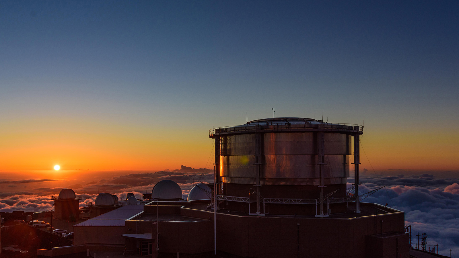
Why would a space environmentalist like me take so much interest in Polynesian wayfinding? Because the U.S. Space Force, which also looks to the sky, has a facility on the Hawaiian island of Maui called the Maui Space Surveillance Complex atop Mount Haleakalā. I worked there for several years doing space surveillance and tracking research to infer the behavior of objects in near-Earth space. It was a true joy for me and my family to live in the town of Makawao, in a region known to locals as Upcountry, on the slopes of Haleakalā. There were times on Maui when my native Hawaiian friends would share their frustration at feeling displaced and excluded from any decision-making regarding the use of the facilities on top of their sacred mountains. I never understood why the state and local government, and industry, never closed the educational gap on Maui, hindering native Hawaiians from being indispensable partners and contributors to space surveillance sciences and technologies. It is painfully ironic that these indigenous peoples are unmatched in wayfinding, being demonstrably great interpreters of data coming from our sky, and yet they’re in absentia regarding the work and decisions on their islands for space surveillance. A child born in Makawao today should be able to direct the Maui Space Surveillance Complex tomorrow and never have to leave the island. This statement, at present, is unachievable. That’s a problem, but there are current efforts to mitigate this, such as the Hawai’i’s Engaged STEM Pathways program to link high school students from these underrepresented populations with the opportunity to earn STEM degrees in the University of Hawaii system.
To be sure, detecting, tracking and identifying the 30,000 objects orbiting the Earth as a consequence of human activities is a non-trivial task, even with the best sensing technology and skilled scientists and engineers. However, if we provided Polynesians with all the data we have gathered on these objects, along with the space weather data and other sources of information, they could apply their wayfinding principles and provide us with their own perspective and understanding of the proliferation of space debris and traffic that is in desperate need of holistic management and coordination. What I mean is that Polynesians have a process for interpreting data to better understand their environment and how to be successful at navigating on the seas. Perhaps they could apply the same empirical principles to space data and help humanity get a better understanding of the current space traffic problem and even how we could navigate around it, in a matter of speaking.
This contribution to space situational awareness and space traffic management based on Polynesian knowledge could be institutionalized at the Maui Research and Technology Park, a hub for technology and innovation on Maui. This could become manifest as a public-private partnership among government, industry and academia. We could work on getting native Hawaiians educated and employed in space situational awareness, bringing their cultural knowledge to bear on these wicked space problems. As a space environmentalist acknowledging the foundational role of traditional ecological knowledge, I’m all in.
