
Spacecraft owners and operators are showing fresh determination to devise a traffic management scheme that can avoid the historic disruptions to our daily lives that a collision in space could produce. To find solutions, the industry needs to look beyond itself. Kerry Buckley and Tim Gruber of the MITRE Corp. explain.
Kerry Buckley is a vice president at the MITRE Corp., where she runs MITRE’s Center for Advanced Aviation System Development, a federally funded research and development center operated for FAA. She holds a doctorate in industrial and organizational psychology from George Washington University.
Tim Gruber is a mechanical engineering principal in MITRE’s Center for Advanced Aviation System Development, where he leads work on advanced safety concepts for commercial space operations. Gruber served in the U.S. Navy as a nuclear surface warfare officer and holds a master’s degree in mechanical engineering from MIT.
As many as 38 million airline flights fill the global skies in a typical year. On our oceans, ships as large as skyscrapers navigate in commercial harbors among fishing boats, recreational craft and natural navigation obstructions. Day after day, the overwhelming bulk of these aircraft and vessels avoid collisions and navigate safely.
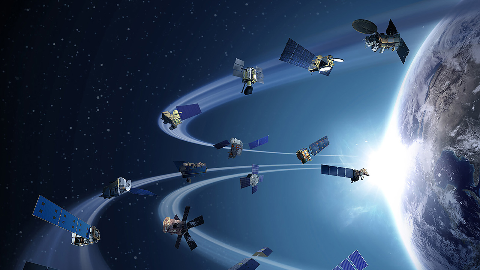
We can learn a great deal about the systems and processes necessary for managing traffic in space by studying the lessons learned over a century of air travel and multiple centuries upon the seas. The maritime and aviation domains now have mature paradigms for avoiding collisions, but such a paradigm does not yet exist for operations in space. Our exploitation of space continues apace and is rapidly changing. The number of objects orbiting Earth tracked by the NASA Orbital Debris Program Office is expected to explode within a decade to over 100,000, a figure that includes active satellites and unknown objects. In low-Earth orbits (where most satellites and debris are), we are close to reaching a traffic density at which collision prevention must become routine.
Today, when a satellite is predicted to have a close approach with another object above certain probability thresholds, the 18th Space Defense Squadron sends a conjunction data message, or CDM, to the satellite owners and operators. It is then up to the owners and operators to analyze the risk and determine what, if any, action to take. MITRE has been monitoring the CDM count per week since 2018 and noticed a fivefold increase in the number of CDMs per week over 2020, largely driven by LEO constellations. Our current collision assessment and mitigation processes cannot withstand this continued growth. We must find a better way.
The maritime realm, in particular, has a lot to teach us. Each ship captain is responsible for avoiding collisions by maintaining situational awareness. Personal observations are combined with information from a suite of onboard instruments that can include cameras, radars, sonars and GPS, all of which refresh at a high rate. Each ship broadcasts its position, velocity, maneuvering capability and intent and listens for the same Automatic Identification System data from other vessels. International “rules of the road” then tell each captain when to “give way” to another vessel based on each vessel’s operational capabilities and relative position: A vessel in a channel must give way if the approaching vessel would risk a collision by changing course or if the approaching vessel would run aground if it were to leave the channel. A vessel overtaking another must keep out of the way of the vessel being overtaken. A vessel must give way to one approaching from the starboard (right) side to cross its path.
Through these maritime rules, a wide variety of vessels navigate safely in relatively narrow channels and shipping lanes that are the functional equivalents of the most popular orbits in space. In contrast to these detailed and well-understood rules, the Outer Space Treaty of 1967 provides only some vague principles of operation, such as “appropriate international consultations before proceeding” and act with “due regard” to others. There is no agreement about how or where to pass another spacecraft, nor requirements for minimum equipage or capabilities to be spaceworthy.
The aviation model also provides some good ideas. While information displayed to pilots refreshes more slowly than the equivalent information in the maritime paradigm, air traffic controllers have high-refresh-rate data and can issue traffic warnings to pilots. Also, airliners carry Traffic Alert and Collision Avoidance System, or TCAS, equipment that transmits radar signals to trigger transponders on nearby aircraft to respond with their course information. If there’s a risk of collision, the TCAS software on the two planes reach agreement on the maneuver that each must perform to prevent a midair collision, and each pilot is alerted by computerized voice. Separation standards are used as the benchmark for both controller- and transponder-directed actions, and professional pilots have ubiquitous understanding of the standards. Minimum equipage is specified for various types of aircraft, and a robust certification program ensures aircraft can perform to the design requirements.
In some ways, the current sensing and avoidance paradigm for space is the worst combination of elements of the maritime and aviation paradigms, with unique challenges thrown in. Orbital velocities and the inability of most spacecraft to maneuver quickly mean that avoidance maneuvers must happen far in advance. Space operators are reliant on data from sensors with slow refresh rates (as in aviation) and are independently responsible for taking avoidance actions (as in maritime), but they must do so without established rules of the road. Then, because of the Outer Space Treaty, the government that allowed the launch is liable for any damages caused by a wrong decision, dragging uninvolved taxpayers in as financially liable stakeholders.
Instead, what’s needed is a paradigm for space that provides owners and operators with a complete operational picture so they can make decisions that result in safe actions. The history of the maritime and aviation sectors points us to the following innovations that would make space a better operational environment for all.
Better sensing:
- Increase the quantity and quality of accessible space sensor data: Both the maritime and aviation paradigms are enabled because of trustworthy, high-quality, consistent and timely data on all potential hazards. Meanwhile, space operations still occur in a low-quality data environment. The United States is creating an Open Architecture Data Repository, a big step in the right direction. This repository, run by the Department of Commerce’s Office of Space Commerce, would combine civil, commercial and international observation data into a standard format. That’s a good start, but we still need more and highly accurate space monitoring systems, whether ground- or space-based, to fill in the existing observation gaps and improve the amount and the quality of tracking data. As data is conglomerated, verifying its integrity will be a key technical challenge. Ideally, we would achieve tracking persistence for all the potentially lethal and currently nontrackable objects, meaning we know where they are and where they are going all the time. Unfortunately, this complete tracking persistence may not be achievable because debris can be very small and hard or impossible to track, but improved tracking persistence is certainly within reach. In an expanded data environment, orbital object custody will be improved, and position errors will be reduced. For optimum functionality, the combined network of ground- and space-based radars and electro-optical telescopes would have continuous coverage of LEO, enabling real-time observations of close approaches between spacecraft. In the near term, just as aviation and maritime concentrate surveillance systems near airports and harbors, the polar regions are high priority for improved space sensor coverage because they are simultaneously very congested and the most susceptible to solar activity. Improving the space sensor network is a perfect place for commercial space monitoring services to contribute and augment the sensors owned by cooperating governments, and this is already starting to happen: LeoLabs, Numerica and others are currently growing their sensing networks.
- Improve the quality of collision predictions: In maritime and aviation operations, captains and crews typically act on collision predictions reliably and promptly. But in recent years, satellite owners and operators have been bombarded with millions of CDMs for collisions that failed to materialize. These false alarms normalize inaction, like the boy who cried wolf. Further, the volume of ever-increasing alerts 1) does not lend itself to manual response and 2) results in a situation where most predicted collisions do not manifest because of the errors in orbital knowledge for the objects involved. Given that the number of predicted conjunctions continues to increase, we need a better way to assess collision risk and automated methods to mitigate them. Increasing the amount of observational data is one piece of the solution, but we also need to improve methods for processing and acting on the data. As an immediate action step, monitoring close approaches that occur within any sensor’s field of view is essential to compute both the collision probability and the actual miss-distance — the point of closest approach — thus closing the feedback loop to improve future collision predictions.
- Increase ephemeris sharing: Aviators via Automatic Dependent Surveillance-Broadcast, or ADS-B, and mariners via the Automatic Identification System, or AIS, have clearly shown that increased sharing of position and velocity information benefits the entire industry and greatly improves safety without providing any competitive advantages. Unfortunately, some commercial space entities consider their satellites’ positions and velocities to be proprietary information. In space, determining the past and future positions of an object, known as ephemeris, requires gaining sufficient orbital data to determine the object’s position and velocity at one time and then using orbital dynamics to determine where the object will be in the future. The U.S. Space Surveillance Network only has custody of an object when the ephemeris is sufficiently accurate to calculate its future position with reasonable accuracy. This can be a resource-intensive process, so the burden of capturing and recording ephemeris cannot fall entirely on the commercial and government tracking services and their sensor observations. Those sensors’ observational time is needed for monitoring close approaches in real time and gaining or regaining custody of debris. It is a waste of sensor resources to establish ephemeris for operational satellites that already self-monitor, so those spacecraft should self-report ephemeris and the status of their ability to maneuver. More recently, space operators are starting to see the benefits of sharing threat data in the Space Information Sharing and Analysis Center, an industry organization dedicated to sharing security threats to the space sector. Given the success of information sharing in all transportation domains, it seems obvious that space operators have a responsibility to share their ephemeris, maneuvering capability and short-term maneuvering intentions in a trusted and symmetric manner so that all stakeholders can trust that the message has provable attribution, has not been altered and cannot be deleted. This would enable more informed decision making by all.
- Increase trackability: Both the maritime and aviation paradigms have minimum equipment standards for different classes of craft; it’s time to implement similar standards for space by developing reasonable requirements based on satellite size and orbital parameters, and special consideration should be given to those design features that enhance the trackability of the spacecraft. New commercial spacecraft could employ active and passive design features like transponders or radar reflectors to aid in both locating and uniquely identifying them. These additions could reduce the integration time for space sensing systems regardless of ephemeris sharing, so sensors can spend more time tracking debris, monitoring close approaches and identifying anomalous behavior. Transponders work on the ocean and in the air, and they’ve already been developed for space. Radar reflectors that bounce microwave waves off their flat, perpendicular surfaces have negligible size, weight and power implications, yet their use is relatively rare today.
Better avoidance:
- Establish ubiquitous maneuvering protocols: Whether you want to call these norms or regulations or are holding out for an international treaty, it is obvious from maritime and aviation that a common understanding of how to prevent the collision of two approaching craft is essential. In particular, the maritime model of “stand on” and “give way” and established hierarchical priorities have proven effective, and we could apply some of those tenets to the space maneuvering protocol. Of course, space collision predictions are probabilistic in nature, so a ubiquitous protocol would also need to establish an acceptable risk threshold for when action should or should not occur, in full acknowledgment of the reality that each maneuver comes at the cost of mission opportunity and lifetime. The U.S. could lead by example by establishing clear expectations for U.S. operators for “due regard” and “appropriate international coordination.” One other way around the legal challenges associated with regulating space operations would be to establish a self-policing, industry-funded entity that reviews collision predictions and passes out unbiased maneuvering directions based on the situation, much as air traffic controllers in most countries do. This entity also needs a rock-solid message and data exchange scheme that is trusted internationally, even by competing nations. For automated collision avoidance managed onboard spacecraft, coordination services could be developed for constellation-to-constellation coordination between industry competitors.
- Increase the percentage of readily maneuverable space objects: Ultimately, collision detection and maneuvering protocols are meaningless if the objects involved are unable to readily maneuver, which is an all-too-common condition. So, object maneuverability needs to be a priority, and that means developing and sharing technical solutions across industries and governments internationally, then holding each other accountable, including for implementing a viable solution for each spacecraft before authorizing the mission. There are many feasible ways to increase the percentage of readily maneuverable space objects, such as actively deorbiting spacecraft at the end of their missions, making spacecraft refuellable and standardizing servicing connection points. All these options make collisions less likely and should be pursued.
- Define minimum equipage and capabilities for various orbital regimes: Ships and aircraft have minimum equipment lists that must be met, and the lists change depending on the specific operating environment. Vastly dissimilar or hazardous operations are carried out in segregated air or ocean space to improve safety and operations for all. So far, no equivalent standards have been developed for spacecraft intended for different orbital regimes, and this needs to be remedied. If the ubiquitous norms inadvertently prioritize creating and launching satellites that cannot maneuver, the overall operational environment will become even more challenging. The minimum equipage requirements could come from the regulators, or the launch service providers could band together and fill this void by refusing to deliver nonmaneuverable satellites to congested orbits.
- Improve satellite control: At sea and in the air, pilots and captains are required to pass medical examinations and rigorous qualification examinations to make sure they can respond appropriately to various situations that arise, including weather events. In space, autonomous control systems are growing in prevalence, but there are no reliability certifications and little publicly available information on the control systems’ risk tolerance. When humans are still in the loop, like deciding when to launch, some decisions are made that are difficult to justify in hindsight, such as launching into known solar storms. Improving the decision-making process and sharing the determining parameters, whether autonomous or not, is necessary to keep space a safe place for business. As more information is shared, the owners’ and operators’ body of knowledge will grow, improving operational competency and space operational predictability for all.
Improving the sensing and avoidance paradigm for space operations is going to require not just a whole-of-nation approach but “most of world.” But importantly, that doesn’t mean whole-of-world formal agreement is essential, as evidenced by maritime operations. Several nations including the U.S. have not signed or ratified the United Nations Convention on the Law of the Sea, but their vessels still abide by those rules due to overwhelming global pressure and their own self-preservation interests. We think space could play out in a similar manner, especially if LEO constellation owners and operators lead the way, building on the recently published AIAA “Satellite Orbital Safety Best Practices” guide.
Let’s take what we can learn from the hard-earned experience of those who’ve navigated the seas and flown the Earth’s skies to avoid future collisions in space — and do it now, before launching thousands of new satellites, nuclear-powered spacecraft and human explorers.
