Stay Up to Date
Submit your email address to receive the latest industry and Aerospace America news.
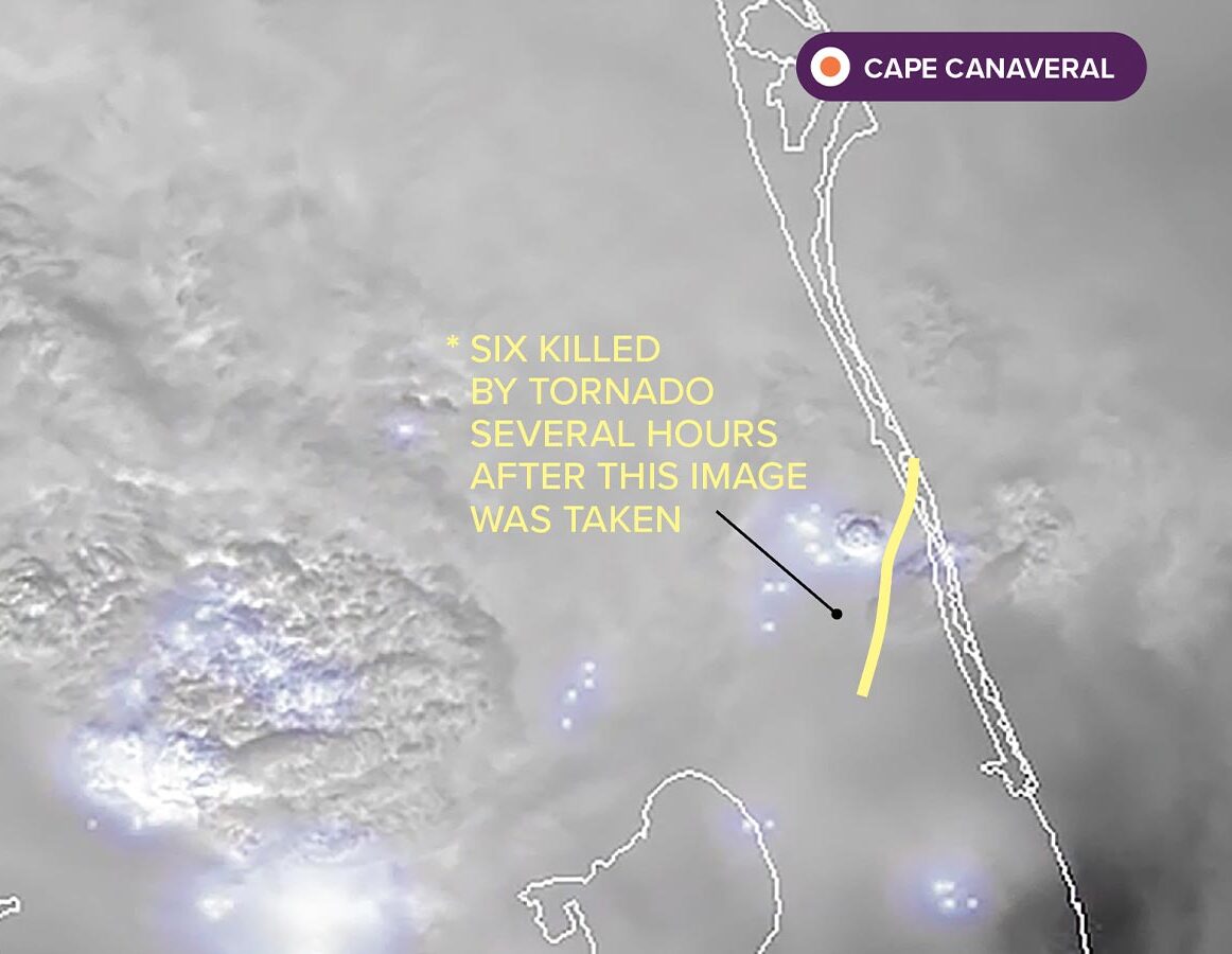
Hurricanes often spawn tornadoes, but Milton’s were particularly numerous and strong for a Florida storm. Images like this one from GOES-16, showing lightning flashing over Southwest Florida, helped forecasters issue tornado warnings with maximum lead time as the storm moved east. “The flash rates were very high with the tornado-bearing cells and thus confidence was increased,” forecasters from the National Weather Service’s Melbourne office explained by email. Forty-two tornado warnings were issued over six hours, a record for the office. With the advent of fine-resolution lightning mappers in space, starting with GOES-16, “forecasters no longer need an algorithm to tell them the flash rate has jumped; they can visually see it in the data,” said Chris Schultz, a lightning scientist at NASA’s Marshall Space Flight Center in Alabama.
THE IMAGE: Milton was imaged by GOES-16 on Oct. 9 at 1:30 p.m. Lighting detections from the satellite’s Geostationary Lightning Mapper were overlaid on an infrared image from its Advanced Baseline Imager.
THE CONTRACTORS: Lockheed Martin built GOES-16 in Littleton, Colorado, and the Geostationary Lightning Mapper in Palo Alto, California. L3Harris made the Advanced Baseline Imager in Fort Wayne, Indiana.
THE TECHNOLOGY: ABI’s internal mirrors scan Earth to produce images in multiple modes, including one that images specific weather features as often as every 30 seconds, as was done with Milton. The Geostationary Lightning Mapper is a near-infrared camera that generates hundreds of images a second.
THE DEADLY TORNADO: The EF3 tornado that struck the Spanish Lakes Country Club Village was unusually strong for a Florida hurricane, according to National Weather Service forecasters.*

About Ben Iannotta
As editor-in-chief from 2013 to March 2025, Ben kept the magazine and its news coverage on the cutting edge of journalism. He began working for the magazine in the 1990s as a freelance contributor. He was editor of C4ISR Journal and has written for Air & Space Smithsonian, New Scientist, Popular Mechanics, Reuters and Space News.
Related Posts
Stay Up to Date
Submit your email address to receive the latest industry and Aerospace America news.


