
An unusual broadband strategy edges toward reality
Help could be on the way for Alaskans who lack broadband internet, and it’s in the form of a kitchen-range-sized satellite called MicroGEO whose design has almost been cleared by engineers for manufacturing.
The San Francisco startup Astranis wants to position the first MicroGEO over the equator in line with Alaska, which means that from the vantage point of the customer it will orbit higher over the horizon than other geosynchronous satellites. This will create line-of-sight to the maximum number of satellite dishes. Astranis plans to apply the $100 million it has raised to implement this approach in other regions of the world with dozens of satellites.
First, though, engineers had to make sure that the Alaskan MicroGEO and those to come could survive years of alternating between hot sunlight and cold, dark space.
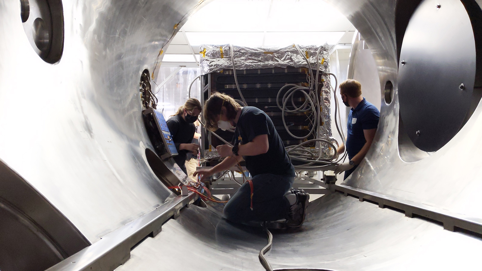
Astranis engineers turned to NTS, a testing, inspection and certification company headquartered in California. Wearing masks to prevent the spread of covid-19, they loaded a qualification model of MicroGEO into the thermal vacuum test chamber in Los Angeles operated by NTS and ran some tests that concluded in June.
“We put the spacecraft through the full range of temperatures you expect it to see on orbit and then some,” said John Gedmark, Astranis CEO and co-founder.
Engineers subjected the model to pressures as low as one-hundred-millionth the density of Earth’s atmosphere and temperatures ranging from minus 120 to 65 degrees Celsius.
The model passed thermal vacuum testing, one in a series of steps to clear the way to start building the first of the 350-kilogram satellites. The first one will serve Alaska, and plans call for launching it next year on a SpaceX rocket to be determined.
Alaskan telecommunications company Pacific Dataport Inc. of Anchorage signed a long-term agreement last year to lease capacity on this first MicroGEO.
Many of Alaska’s remote communities are not well served by fiber-optic communications networks, and Astranis believes that existing GEO satellites are of little help either.
“Alaska gets a smidgen of capacity on the edge of the area the satellites can cover,” Gedmark said. “People in Alaska putting a satellite dish on their roof for MicroGEO will not be pointing it as close to the horizon as they do today.”
