
One headwind facing urban air taxis is, well, the wind
If hundreds of air taxis are ever to ferry passengers or cargo around major cities, they will have to contend with urban wind environments — the most extreme being urban canyons between high-rise buildings that can funnel and accelerate wind and cause turbulence on city rooftops.
While helicopters have served as air taxis in some large cities, the anticipated proliferation of electric air taxi rotorcraft would represent a new scale of aviation in such environments. As far as NASA knows, no one can yet predict the impact of wind and turbulence on air taxi operations, or what kinds of cityscapes and locations drive the strongest winds.
Predicting wind environments is a “very important hurdle for [advanced air mobility] to cross if we want to see widespread urban service” because there are “very complex wind flows in an urban setting,” explained Luke Bard, a NASA meteorologist who is conducting wind research.
Wind turbulence and wind shear can cause extreme turbulence and has, on occasion, led to air crashes. Better prediction could enhance safety and also help the industry anticipate how frequently wind conditions might ground flights in some cities.
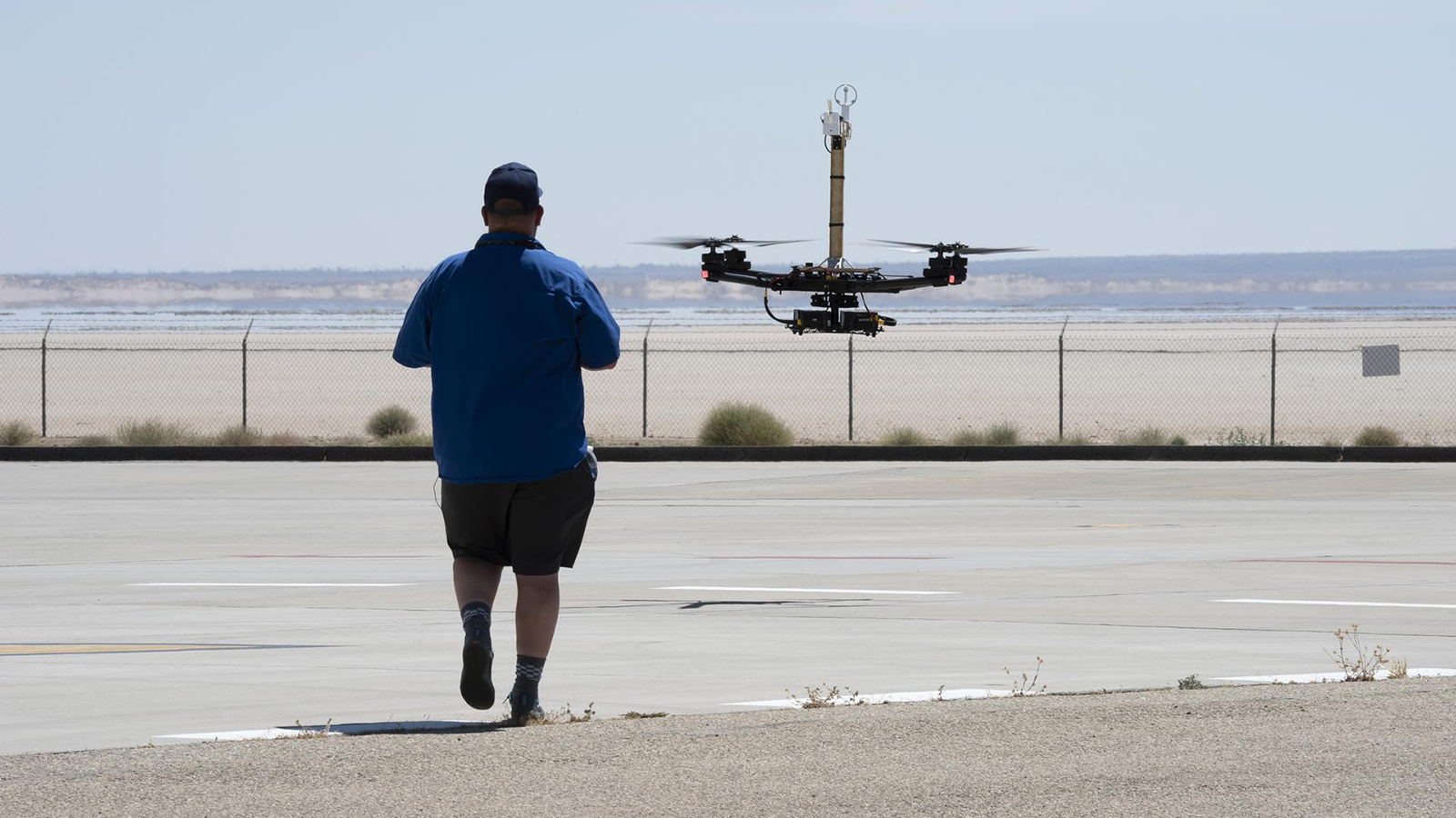
Bard and others at NASA’s Armstrong Flight Research Center in July initiated their Advanced Exploration of Reliable Operation at Low Altitudes: Meteorology, Simulation and Technology campaign. The goal was to fill in knowledge gaps about urban wind characteristics to improve weather prediction models and computer-based simulations. Over the span of two months, they flew remotely controlled drones — a quadcopter and a fixed-wing airplane — and weather balloons outfitted with sensors near Armstrong buildings in Southern California to measure how wind gusts and air swirling from rotors or propellers were affected by the proximity to those buildings.
“It’s like sending in the canary in the coal mine first, you know, the smaller vehicles used in these tests,” Bard said. “They will help us understand how larger air taxis will be affected by weather in dense urban areas.”
I viewed the drones in Armstrong’s Model Lab during a visit there in September, such as the fixed-wing DROID 2, Dryden Remotely Operated Integrated Drone. The 3-meter wingspan drone has been deployed for many experiments at the center by switching out instruments on board to gather various types of weather and aircraft information.
During the project, sensors on the aircraft and on the ground measured temperature, pressure and relative humidity, along with wind speeds. While Armstrong isn’t an urban area, researchers said its buildings provided a suitable environment to gather data about flying in cities.
Armstrong is inside Edwards Air Force Base, which has nearly constant strong winds coming down from nearby mountains into the surrounding desert basin. Flights were conducted below 2,000 feet. NASA said ground instruments at the facility also detected weather conditions during the drone flights. Those include a 40-meter-tall tower outfitted with ultrasonic wind sensors and several smaller weather stations that sample wind flows through the area. An additional sensor measures winds aloft by emitting sound pulses, according to the agency.
NASA is still sifting through the information gathered from the sensors and isn’t ready to release findings yet, Bard said, but plans to publish those results in the next year or two in engineering papers.
NASA believes air taxi services will require nowcasting — predicting how weather conditions might change within an hour or in minutes, Bard said. But such immediate forecasts are likely to require more extensive weather instruments or infrastructure in urban areas.
“One thing we are trying to understand is, do you need really expensive instruments to do this such as lidar?” he said. “Or could we do this with, you know, less expensive instruments?”
Weather information gathered will be used for “training novel machine learning models that have shown promise for making rapid and accurate estimations of the winds in vehicle landing zones that might be impacted by nearby buildings,” according to NASA.
Researchers also intend to develop technology that could enable aircraft to process weather data onboard and share that with nearby vehicles.
Once NASA crunches the data, it also plans to expand the drone testing to other locations to find out whether certain urban areas produce unique conditions and why, Bard says. Research in such areas may focus more heavily on humidity or storm prediction, he said.
“There are places like coastal areas, say Seattle or Boston, New York City that have their own weather patterns. Some areas are more affected by fog or low clouds. And some areas like Florida may have more frequent thunderstorms at times of the year, so we will need to understand those differences,” he said.
