
For NOAA’s new weather satellite, the luxury of time
NOAA’s newest Geostationary Operational Environmental Satellite will spend as long as a year undergoing testing from its orbital location overlooking the central part of the U.S. Once that is done, the new weather spaceceraft will be maneuvered into an operating position with a bird’s eye view of one of the U.S. coasts – NOAA has not yet decided which one.
NOAA expects to have the luxury of time to try out the satellite’s imagery and lightning maps, because the current GOES satellites remain healthy, says NOAA’s Greg Mandt, system program director for the new satellite and three more to come in the new series.
The 5,000-kilogram satellite was launched Nov. 19 as the vanguard of an $11-billion series that will deliver four times as much imaging detail, five times more often than the current generation. “For the forecasters, this is a once-in-a-career jump in capability,” Mandt says. This will be the first major technology refresh of the long running GOES program in more than two decades. The program includes an entirely new ground system built by Harris Corp. in Melbourne, Florida, for data analysis, distribution and operations through 2036.
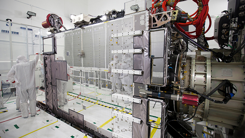
The new spacecraft was called GOES-R during its construction by Lockheed Martin under NASA management, but once NOAA took charge of the spacecraft in orbit it was redesignated GOES-16, as is standard procedure. GOES-R is also the name of the satellite series, and construction is underway on the next two spacecraft, GOES-S and T.
The main sensor on GOES-16 is the Advanced Baseline Imager built by Harris’ unit in Fort Wayne, Indiana The ABI’s improved resolution and more frequent transmissions will translate into more timely and accurate forecasts of the intensity and track of severe storms, NOAA says. When a hurricane is approaching, authorities should be able to determine more quickly which areas require evacuation and which do not.
Forecasters are also looking forward to receiving data from the spacecraft’s Geostationary Lightning Mapper, because it will help them better predict tornado formation, Mandt says.
GOES-16 deployed its solar arrays soon after launch and by mid December had activated its sensors in anticipation of tests that will continue through mid to late 2017. Two to three months will be spent checking out the hardware to make sure everything is operating as planned, and then comes calibration of the instruments, Mandt says.
Once testing is completed, NOAA will decide on the permanent operating location for GOES-16. The choice between the East and West Coasts will depend on the health of the current satellites. NOAA likes to maintain three satellites in geostationary orbit about 35,000 kilometers above the equator. GOES-13, positioned over the east, was launched in 2006 and GOES-15 was launched in 2010. GOES-14 is in orbital storage between them in case it is needed.
Other NOAA satellites fly in low Earth orbit from pole to pole to examine weather patterns up close and spot storms brewing outside the GOES coverage footprint, which stops short of the polar regions. ★
