
Mapping Bennu
If NASA’s OSIRIS-REx mission were a play, the star would be the disk-shaped suction mechanism that in August will attempt to pull small rocks and dirt off the asteroid Bennu’s surface for return to Earth in 2023. But every star needs a cast of supporting actors, and one of the key ones has turned out to be OLA, short for OSIRIS-REx laser altimeter.
“OLA became much more significant once we saw the surface of Bennu,” says Michael Daly, the instrument scientist for OLA at York University in Ontario, referring to the craggy rocks and deep craters that surprised scientists when OSIRIS-REx began orbiting Bennu in December 2018. Scientists had expected a relatively smooth surface, with just a few areas to be logged as inaccessible after scanning by OLA.
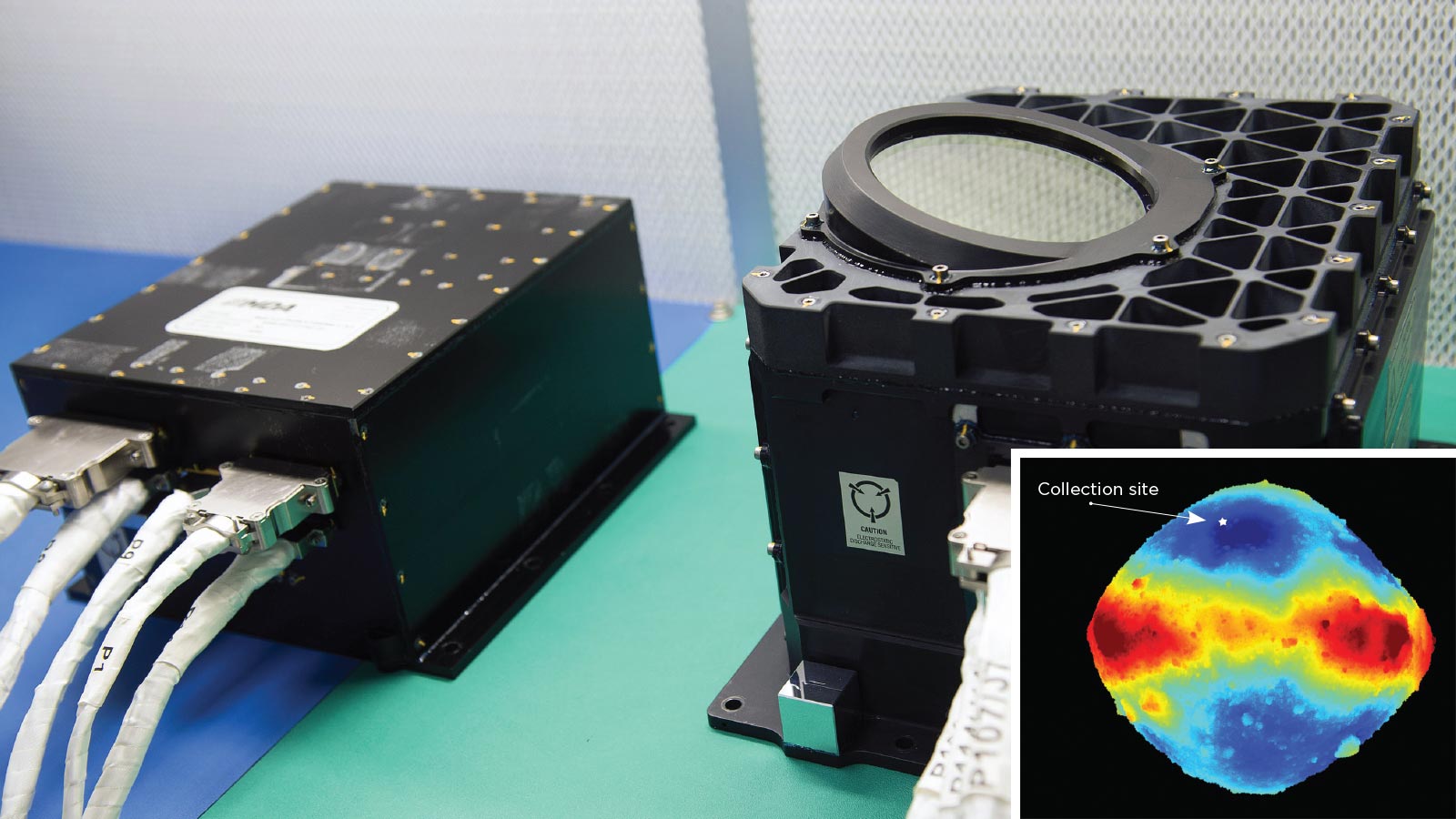
With selection of the collection site now looking trickier, OLA began its work of mapping Bennu by bouncing lasers off its surface and measuring how long the reflections took to arrive at its receiver. These value tables, stored in the instrument’s electronics box, were downlinked to the University of Arizona in Tucson, where imaging software turned them into color-coded 3D maps.
The process began with OLA’s high-energy laser transmitter, or HELT, which fired 100 light pulses per second from a 7-kilometer orbit. Once the spacecraft descended to 1 kilometer above Bennu’s surface last June, OLA’s low-energy laser transmitter, LELT, took over, firing 10,000 pulses per second.
Over the next two months, LELT made approximately 3 billion measurements that scientists turned into a terrain map of Bennu with a resolution of about 5 centimeters. Based on those scans, NASA in December chose a 16-meter swath in Bennu’s north polar region, nicknamed Nightingale, for the sample collection.
Luckily, scientists got what they needed from LELT before it stopped firing its laser in February for reasons that are still being investigated. “It is sad,” Daly says, “but we captured all the science data we really expected and more.”
OLA has two transmitters because lidar instruments “have to make a trade” between distance and detail, says Dante Lauretta, principal investigator for OSIRIS-REx. “When you’re using the low energy transmitter, you can send a lot more pulses out rapidly, but they’re not as energetic and therefore you can’t be far away from the asteroids. So you trade a longer distance for a lower sampling rate.”
Its mapping task completed, range data from OLA now focuses one of the on-board cameras, PolyCam, ensuring that its pictures are “nice and crisp and clear,” Lauretta says. Those pictures and range data go to the flight computer’s Natural Feature Tracking catalog that OSIRIS-REx will consult as it navigates its collection arm to the surface.
